
Old Ordnance Survey Maps of County Durham
This is our coverage of County Durham. The present Durham County Council unitary authority was formed in 2009 with the aboliton of the district councils of Chester-le-Street, Derwentside, City of Durham, Easington, Sedgefield, Teesdale and Wear Valley. Darlington Borough became a unitary authority in 1989 but remains within County Durham for ceremonial purposes and some services are shared.
See separate pages for the maps of Gateshead, Sunderland and South Tyneside, which became part of Tyne & Wear in 1974, and for Hartlepool and Stockton-on-Tees which became part of the short-lived Cleveland county in 1974. These all remain unitary auhorities.
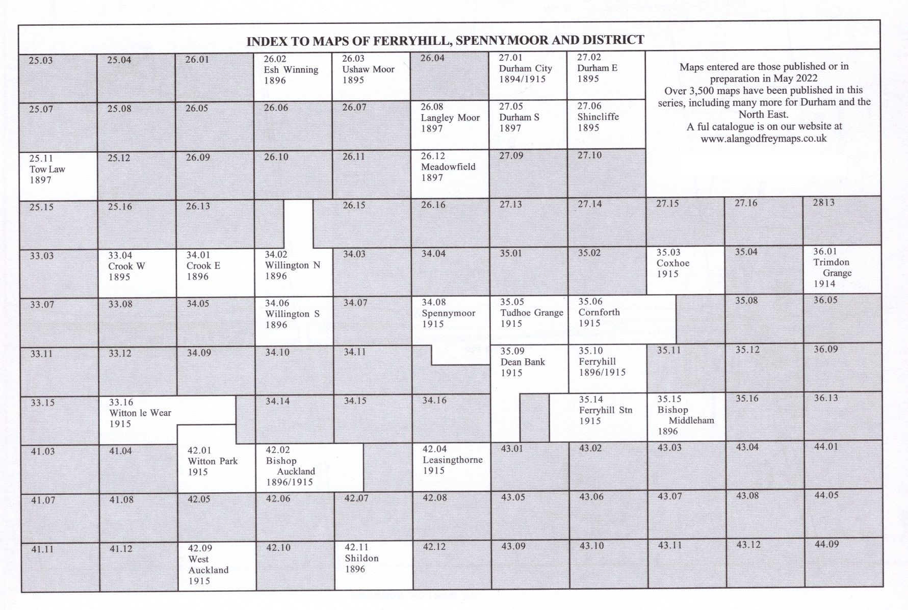
 These are the maps we publish in County Durham:
