Old Ordnance Survey Maps of County Durham

  • These detailed maps normally cover an area of about one and a half miles by one mile. Each map includes an introduction.
  • They are available through our On-line Mapshop

  • Here are the details of maps for Shotley Bridge:

  • Co Durham 11.06 Shotley Bridge (North) 1916 - published 2018; intro by Alan Godfrey. ISBN.978-1-78721-154-4

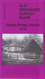
    This map covers the northern part of Shotley Bridge and the western edge of Medomsley.

    Features include railway with Shotley Bridge station, Cottage Homes, part of Medomsley Colliery, Hassockfield Quarry, Elm Park Farm, Home for the Aged & Infirm (later Shotley Bridge Hospital), Sanatorium, Whinny House, Summerhill, Snow's Green, Shotley House, Springfield House, Summerdale, Meeting Room, Shotley Lodge, Shotley Park, Assembly Rooms, Shotley Bridge Spa, Derwent Lodge etc.

    The map links up with Sheets 11.10 Blackhill to the south.


  • Follow this link for a complete list of our Durham maps.
  • You can order maps direct from our On-line Mapshop. For other information and prices, and other areas, go to The Index Page.
  • Maps in the Godfrey Edition are taken from the 25 inch to the mile map and reduced to about 15 inches to the mile. For a full list of maps for England, return to the England page.
    Alan Godfrey Maps, Prospect Business Park, Leadgate, Consett, Co Durham, DH8 7PW / sales@alangodfreymaps.co.uk / 25 June 2018