Old Ordnance Survey Maps of County Durham
Durham Pit Villages
These detailed maps normally cover an area of about one and a half miles by one mile. Each map includes an introduction.
They are available through our On-line Mapshop
At the heart of Durham's industrial heritage are its pit villages, some of which have
grown into small towns, while others virtually disappeared under the county's notorious 'Category D' policy in the 1950s. We publish numerous maps of the Durham
Pit Villages. Here is a selection, though many of the other maps in Durham, Gateshead, South Tyneside and Sunderland include collieries. Work is currently underway on maps for Murton and Shotton Colliery.
05.11 Chopwell 1915 - published 2018; intro by Neil Gander
05.15 Blackhall Mill & Hamsterley Colliery 1915 - published 2018; intro by Neil Gander
06.13 Burnopfield 1895 - published 2002; intro by Tom Oliphant
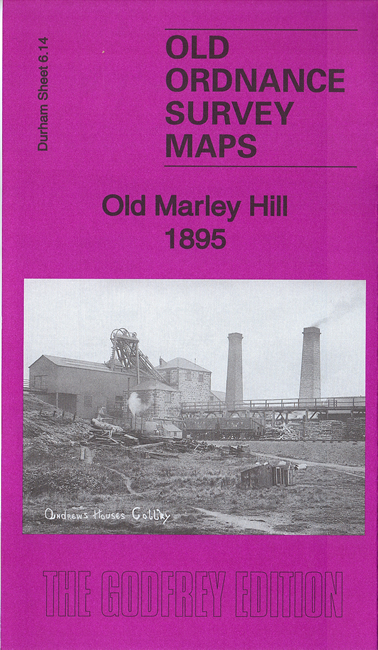
06.14 Old Marley Hill 1895 - published 2017; intro by Alan Godfrey
11.08 Dipton 1916 - published 2008; intro by Alan Godfrey
11.11a Leadgate 1895 - published 2000; intro by John Griffiths
11.11b Leadgate 1916 - published 2016; intro by Neil Gander
12.01 Hobson & Tantobie 1895 publ 2004; intro by Tom Oliphant
12.02 East Tanfield & Causey Arch 1895 - published 2005; intro by Alan Godfrey
12.06a Stanley 1895 - published 1995; intro by David Butler
12.06b Stanley 1915 - published 2013; intro by Alan Godfrey
12.07 No Place, Beamish & West Pelton 1895 - publ 2005; intro by David Butler
12.08 Pelton & Urpeth 1895 - publ 2005; intro by Dorothy Rand
12.09 Annfield Plain 1896 - published 2001; intro by John Griffiths
12.10 South Moor & West Stanley 1915 - published 2016; intro by Alan Godfrey
12.12 Pelton Fell & Newfield 1915 - publ 2005; intro by David Butler
12.15 Craghead 1895 - published 2000; intro by Tom Oliphant
13.06 Harraton & Fatfield 1895 - published 2017; intro by Alan Godfrey
13.07 Penshaw 1895 - published 2016; intro by Alan Godfrey
13.11 Shiney Row & Bournmoor 1895 - published 2016; intro by Alan Godfrey
13.12 Newbottle, Philadelphia & New Herrington 1895 - published 2017; intro by Alan Godfrey
13.15 Fencehouses & New Lambton 1895 - published 2016; intro by Alan Godfrey
13.16 Houghton-le-Spring 1895 - published 2001; intro by John Griffiths
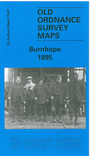
19.02 Burnhope 1895 - published 2000; intro by Tom Oliphant
19.03 Holmside & Edmondsley 1896 - published 1998; intro by David Butler
19.08 Sacriston 1897 - published 1997; intro by David Butler
19.11 Witton Gilbert & Langley Park 1895 - published 2008; intro by Alan Godfrey
20.04 Hetton Downs & Rainton Bridge 1895 - published 2006; intro by David Butler.
20.08 Hetton-le-Hole & East Rainton 1895 - published 2007; intro by David Butler.
21.03 Seaham Harbour 1895 - published 1984, 2nd Edition 2010; intro by Alan Godfrey
21.09 Easington Lane & South Hetton 1896 - published 2005; intro by David Butler.
25.11 Tow Law 1897 - published 1999; intro by David Butler
26.02 Esh Winning 1895 - published 2019; intro by Alan Godfrey
26.03 Ushaw Moor 1895 - published 2018; intro by Alan Godfrey
26.08 Langley Moor 1897 - published 1997; intro by David Butler
26.12 Meadowfield 1897 - published 1997; intro by David Butler
33.04 Crook (West) 1895 - published 2002; intro by Alan Godfrey
34.01 Crook (East) 1896 - published 2001; intro by Alan Godfrey
Follow this link for a complete list of our Durham maps.
You can order maps direct from our On-line Mapshop.
For other information and prices, and other areas, go to The Index Page.
Maps in the Godfrey Edition are taken from the 25 inch to the mile map and reduced to about 15 inches to the mile.
For a full list of maps for England, return to the England page.
Alan Godfrey Maps, Prospect Business Park, Leadgate, Consett, Co Durham, DH8 7PW / sales@alangodfreymaps.co.uk / 14 January 2018