 Here are the details of maps for Birtley:

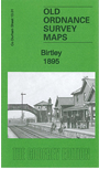
This detailed map covers Birtley, just north of Chester-le-Street but today within Gateshead MBC.
Features include NER railway with station, Pelaw Main Wagonway, Birtley Iron Works, Bewicke Main Wagonway, Ouston Colliery E Pit, various sidings, several brick works, Leafield House, Birtley Hall, St John's church, Birtley House, St Joseph's RC church, White House, Portobello, Blackfell Engine etc. We include an 1894 directory of Birtley on the reverse.
The map links up with Co Durham 7.13 Birtley North to the north.
Maps in the Godfrey Edition are taken from the 25 inch to the mile map and reduced to about 15 inches to the mile. For a full list of maps for England, return to the England page.
Alan Godfrey Maps, Prospect Business Park, Leadgate, Consett, Co Durham, DH8 7PW / sales@alangodfreymaps.co.uk / 14 January 2018