Old Ordnance Survey Maps of County Durham

  • These detailed maps normally cover an area of about one and a half miles by one mile. Each map includes an introduction.
  • They are available through our On-line Mapshop

  • Here are the details of maps for Durham (East):

  • Co Durham Sheet 27.02 Durham City (East) 1894 - published 2005; intro by David Butler. ISBN.978-1-84151-832-9

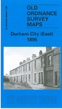
    This very detailed map covers the eastern part of the City of Durham, with coverage stretching from Gilesgate eastward to Sherburn Grange and, near the SE corner, Sherburnhouse station. Sunderland Road and Sherburn Road fan out across the map, surrounding Gilesgate Moor, which is beginning to be developed with new settlements such as Dragon Villa, New Durham and Alma Place. We include extracts from a trade directory on the back.

    The map links up with Sheets 27.02 Durham City to the west, 27.06 Shincliffe to the south.


  • Follow this link for a complete list of our Durham maps.
  • You can order maps direct from our On-line Mapshop. For other information and prices, and other areas, go to The Index Page.
  • Maps in the Godfrey Edition are taken from the 25 inch to the mile map and reduced to about 15 inches to the mile. For a full list of maps for England, return to the England page.
    Alan Godfrey Maps, Prospect Business Park, Leadgate, Consett, Co Durham, DH8 7PW / sales@alangodfreymaps.co.uk / 14 January 2018