Old Ordnance Survey Maps of Durham


We have published more than 1,900 maps in our series of Old Ordnance Survey Map reprints, including a large group in County Durham, where we are based. The maps are highly detailed. They are taken from the OS 1:2,500 (or 25 inch) maps and reduced to about 15 inches to the mile. Each covers an area of a mile and a half by a mile. They show streets with individual houses, tram tracks, railway tracks and even signals, factories, wharves and such details as fountains and water troughs. They will provide hours of fascination for historians and genealogists. The maps are neatly folded and each includes a specially written introduction to the area. Maps can be purchased on our On-line Mapshop where further information about titles is given. Or visit The Index Page for a full list to the series and details of Prices.


  • Here are the details of maps for Durham City:
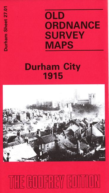
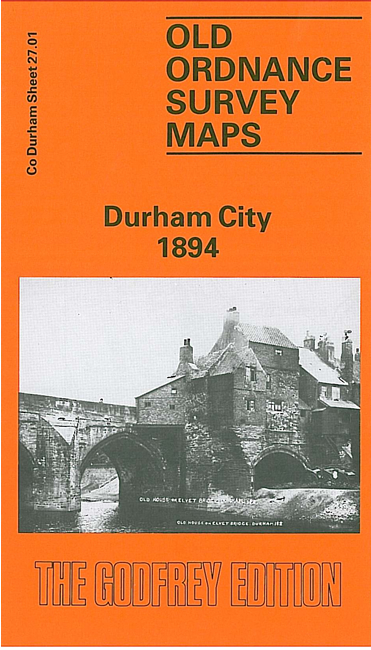
  • Co Durham Sheet 27.01 Durham 1894 - published 1990; introduction by Alan Godfrey

    This very detailed map covers the City of Durham, with its glorious cathedral, thought by many to be the finest building in England. Our map covers the core of the city, including the whole of the cathedral area on its loop in the River Wear. The map extends west to Neville's Cross, east to much of Gilesgate. Features on the map include the Cathedral, University, Castle, South Bailey, North Bailey, Old Elvet, Prison (left blank for security reasons), Claypath, Gilesgate goods station, Elvet station, main NER station, Bede College, St Giles church, carpet manufactory, Workhouse, Grammar School, Neville's Cross, County Hospital, Western Hill, St Cuthbert's church, disused mills, Crook Hall. A few directory extracts are on the back.

    The map links up with Sheets 20.13 Durham (North) to the north, 27.02 Durham City (East) to the east, 27.05 Durham City (South) to the south.

    You might find this index map useful.


    Follow this link for a complete list of our Durham area maps.

    You can order maps direct from our On-line Mapshop. For other information and prices, and other areas, go to The Index Page.


    Maps in the Godfrey Edition are taken from the 25 inch to the mile map and reduced to about 15 inches to the mile. For a full list of maps for the North East, return to the North East page.

    The Godfrey Edition / godfreyedition@btinternet.com / 17 April 2008