Old Ordnance Survey Maps of Durham (South)


We have published more than 1,900 maps in our series of Old Ordnance Survey Map reprints, including a large group in County Durham, where we are based. The maps are highly detailed. They are taken from the OS 1:2,500 (or 25 inch) maps and reduced to about 15 inches to the mile. Each covers an area of a mile and a half by a mile. They show streets with individual houses, tram tracks, railway tracks and even signals, factories, wharves and such details as fountains and water troughs. They will provide hours of fascination for historians and genealogists. The maps are neatly folded and each includes a specially written introduction to the area. Maps can be purchased on our On-line Mapshop where further information about titles is given. Or visit The Index Page for a full list to the series and details of Prices.


  • Here are the details of maps for Durham (South) & Houghall:

  • Co Durham Sheet 27.05 Durham City (South) 1897 - published 1997; introduction by David Butler

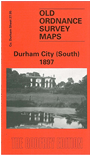
    This is one of a small group of maps covering Durham, and covers the southern suburbs of the city. The area was still largely rural in 1897 with a scattering of large houses and villas such as Elvetmoor House, Oswald House, Elvet Hill, Hollinside. The hamlet of Houghall is towards the SE corner. The small Elvet Colliery is at the top of the map along with Quarryhead Lane and Charley's Cross. Other features include Houghall Hospital, Mountjoy Reservoir, Hollinside Wood, Observatory, St Cuthbert's cemetery. The crossroads with the Duke of Wellington pub is towards the NW corner. On the reverse we include a large section of the 1919 Edition, showing how the area was developing.

    The map links up with Sheets 27.01 Durham City to the north, 26.08 Langley Moor to the west and 27.06 Shincliffe to the east.

    You might find this index map useful.


    Follow this link for a complete list of our Durham area maps.

    You can order maps direct from our On-line Mapshop. For other information and prices, and other areas, go to The Index Page.


    Maps in the Godfrey Edition are taken from the 25 inch to the mile map and reduced to about 15 inches to the mile. For a full list of maps for the North East, return to the North East page.

    The Godfrey Edition / godfreyedition@btinternet.com / 4 August 2006