
 Here are the details of maps for Trimdon Grange & Trimdon Colliery:

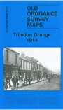
This detailed map covers two villages: Trimdon Grange, near the centre of the map, and much of Trimdon Colliery, about half a mile away. Features include Trimdon Grange Colliery, old quarries, Trimdon Colliery (disused), the Ferryhill & East Hartlepool railway, Trimdon station, Deaf Hill, St Paul's church. The villages are shown in detail, with railway tracks, houses and outhouses. On the reverse we include an 1894 directory of Trimdon. This map will be invaluable to all students of Durham's mining villages; please note that it does not show the more rural Trimdon Village which appears on the reverse of our Hartlepool & East Durham 1913 One Inch map.