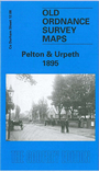
Co Durham Sheet 12.08 Pelton & Urpeth 1895 - published 2005; intro by Dorothy Rand. ISBN.978-1-84151-805-3 
This very detailed map covers the village of Pelton, just west of Chester-le-Street. Coverage extends north to Urpeth and part of Ouston, and NW to High Urpeth. Features include the NER
Annfield Plain Branch, Beamish Wagonway, Holy Trinity church, Urpeth Lodge, Perkinsville, Urpeth Colliery, Low Urpeth Colliery,
Urpeth Wagonway, coke ovens. On the reverse we include a directory for Pelton Parish.
The map links up with Sheet 12.07 No Place to the west, 12.12 Pelton Fell to the south.
Follow this link for a complete list of our Durham maps.
You can order maps direct from our On-line Mapshop.
For other information and prices, and other areas, go to The Index Page.
Maps in the Godfrey Edition are taken from the 25 inch to the mile map and reduced to about 15 inches to the mile.
For a full list of maps for England, return to the England page.
Alan Godfrey Maps, Prospect Business Park, Leadgate, Consett, Co Durham, DH8 7PW / sales@alangodfreymaps.co.uk / 14 January 2018

 Here are the details of maps for Pelton & Urpeth: