Old Ordnance Survey Maps of Crook


We have published more than 1,900 maps in our series of Old Ordnance Survey Map reprints, including a large group in County Durham, where we are based. The maps are highly detailed. They are taken from the OS 1:2,500 (or 25 inch) maps and reduced to about 15 inches to the mile. Each covers an area of a mile and a half by a mile. They show streets with individual houses, tram tracks, railway tracks and even signals, factories, wharves and such details as fountains and water troughs. They will provide hours of fascination for historians and genealogists. The maps are neatly folded and each includes a specially written introduction to the area. Maps can be purchased on our On-line Mapshop where further information about titles is given. Or visit The Index Page for a full list to the series and details of Prices.


  • We have published two maps for Crook. They link up to provide good coverage of the town. Here are the details:

  • Co Durham Sheet 33.04 Crook (West) 1896 - published 2002; introduction by Alan Godfrey
  • Co Durham Sheet 34.01 Crook (East) 1896 - published 2001; introduction by Alan Godfrey

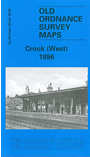
    The Crook West map covers the western part of the town, including High Hope Street, West Road, station, goods station, the northern part of Woodifield Colliery, Freeholders Homes. A major feature is Pease's West, including the NER Pease's West Sidings, chemical works, coke ovens, fireclay works, Pease's West Colliery (Emma Pit) with tramway, West Roddymoor, Red House Colliery. Extracts from a trade directory of 1894 are on the reverse.

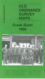
    The Crook East map links up and covers the eastern part of the town, including town centre, St Catherine's church, RC chapel, Wheat Bottom, Royal Hotel, Surtees Hotel. Coverage extends east to Bowden Close, including Bowden Close Colliery (Norwich Pit), Helmington Row, Bowden Close Railway, also disused Job's Hill Colliery, Low Job's Hill. Dowfold Hill is central to the map, and the route of a disused mineral line runs round it. Extracts from a 1902 directory are on the reverse.

    You might find this index map useful.


    Follow this link for a complete list of our SW Durham area maps.

    You can order maps direct from our On-line Mapshop. For other information and prices, and other areas, go to The Index Page.


    Maps in the Godfrey Edition are taken from the 25 inch to the mile map and reduced to about 15 inches to the mile. For a full list of maps for the North East, return to the North East page.

    The Godfrey Edition / godfreyedition@btinternet.com / 20 August 2006