Old Ordnance Survey Maps of Tantobie


We have published more than 2,000 maps in our series of Old Ordnance Survey Map reprints, including a large group in County Durham, where we are based. The maps are highly detailed. They are taken from the OS 1:2,500 (or 25 inch) maps and reduced to about 15 inches to the mile. Each covers an area of a mile and a half by a mile. They show streets with individual houses, tram tracks, railway tracks and even signals, factories, wharves and such details as fountains and water troughs. They will provide hours of fascination for historians and genealogists. The maps are neatly folded and each includes a specially written introduction to the area. Maps can be purchased on our On-line Mapshop where further information about titles is given. Or visit The Index Page for a full list to the series and details of Prices.


  • Here are the details of maps for Tantobie & the Hobson:

  • Co Durham Sheet 12.01 Hobson & Tantobie 1895 - published 2004; introduction by Tom Oliphant

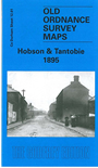
    This very detailed map covers the villages of Tantobie and Hobson, a few miles NE of Consett. Coverage stretches from Tantobie northward to Hobson, and eastward to part of Tanfield. The coke ovens are shown at Hobson, although the colliery is on the Burnopfield map. The Pontop & Jarrow Railway runs through the map and other features include a short stretch of the Linz Colliery Railway, Mountsett Quarries, Mountsett Fell, the routes of old wagonways, Wagonhill Farm, Clough Dene, Tanfield Leith Hall. The portion of Tanfield shown includes Packhorse Inn and Peacock Inn. On the reverse, as well as a short directory of Tantobie, we include information on Durham coalmining from Whelan's Directory 1894.

    The map links up with Sheets 6.13 Burnopfield to the north, and 12.02 East Tanfield to the east.

    You might find this index map useful.


    Follow this link for a complete list of our Derwentside area maps.

    You can order maps direct from our On-line Mapshop. For other information and prices, and other areas, go to The Index Page.


    Maps in the Godfrey Edition are taken from the 25 inch to the mile map and reduced to about 15 inches to the mile. For a full list of maps for England, return to the England page.

    Alan Godfrey Maps, Prospect Business Park, Leadgate, Consett, Co Durham, DH8 7PW / godfreyedition@btinternet.com / 25 July 2007