Old Ordnance Survey Maps of Tanfield


We have published more than 2,000 maps in our series of Old Ordnance Survey Map reprints, including a large group in County Durham, where we are based. The maps are highly detailed. They are taken from the OS 1:2,500 (or 25 inch) maps and reduced to about 15 inches to the mile. Each covers an area of a mile and a half by a mile. They show streets with individual houses, tram tracks, railway tracks and even signals, factories, wharves and such details as fountains and water troughs. They will provide hours of fascination for historians and genealogists. The maps are neatly folded and each includes a specially written introduction to the area. Maps can be purchased on our On-line Mapshop where further information about titles is given. Or visit The Index Page for a full list to the series and details of Prices.


  • Here are the details of maps for Tanfield:

  • Co Durham Sheet 12.02 East Tanfield & Causey Arch 1895 - published 2005; introduction by Alan Godfrey

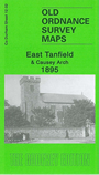
    This very detailed map covers an area stretching from Tanfield village eastward to Beamish Red Row. The Tanfield Railway runs through the map, and features include the famous Causey Arch, Causey Row, Black Horse pub, Beamish Burn, Causey Hall, East Tanfield Colliery, coke ovens. The map just includes St Margaret's church in Tanfield. The map would make a splendid accompaniment to anyone travelling oin the Tanfield Railway and exploring Causey Arch and its various pathways. We also include the Tanfield entry from Whelan's Directory of Durham 1894.

    The map links up with Sheet 12.01 Hobson & Tantobie to the west and 12.06 Stanley to the south.


    Follow this link for a complete list of our Derwentside area maps.

    You can order maps direct from our On-line Mapshop. For other information and prices, and other areas, go to The Index Page.


    Maps in the Godfrey Edition are taken from the 25 inch to the mile map and reduced to about 15 inches to the mile. For a full list of maps for England, return to the England page.

    Alan Godfrey Maps, Prospect Business Park, Leadgate, Consett, Co Durham, DH8 7PW / godfreyedition@btinternet.com / 25 July 2007