
 Here are the details of maps for Darlington (North):

This very detailed map is one of a group of 4 published for Darlington. It covers the north of the town, from the locomotive works and engine sheds northward to Harrowgate Hill. The map is double-sided for maximum coverage. Part of the map is open countryside, for we are at the edge of town, but it is important for completing coverage of the railways of Darlington. Other features include Rise Carr Rolling Mill, St Paul's church, Rise Carr, North Road Recreation Ground, North Cemetery. On the reverse is part of adjacent sheet 55.01 including Drinkfield, a stretch of the Darlington & Consett line and Darlington & Barnard Castle branch, with Stooperdale Junction and Charity Junction.
The map links up with Sheet 55.05 Darlington West and 55.06 Darlington to the south.
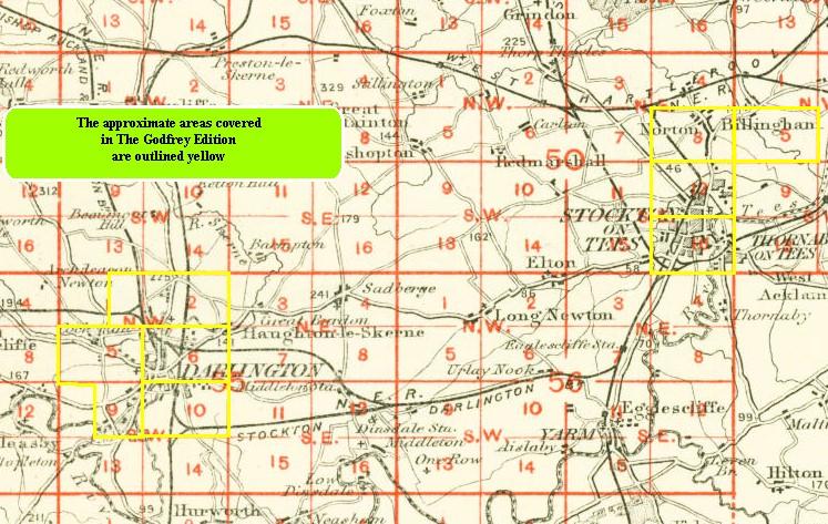
You might find this index map useful.