 Old Ordnance Survey Maps of Kent (Outer London)
 All maps are available from our On-line Mapshop or from selected bookshops in the area.
The following maps are all taken from the OS 25" maps and reduced to a scale of approximately 15 inches to the mile.
They are extremely detailed, showing individual houses, details such as railway tracks, pathways,
pubs, factories and even minutiae such as fountains and signal posts. Obviously they cover quite a small area, normally a mile
by a mile and a half each. Each map includes an introduction. For further details click on the links below.
There is a separate page for Kent, beyond the London area. For them go to this page
 These are the detailed maps currently available in the 'London in Kent' area. Information pages are available for each map; simply
follow the links.
These are the detailed maps currently available in the 'London in Kent' area. Information pages are available for each map; simply
follow the links.
02.12 Belvedere 1895 - published 1993; intro by John A Prichard
02.15 East Wickham & Welling 1862 - published 1999; introduction by Stuart Bligh
02.16 Bexleyheath (North) 1895 - published 1993; intro by Len Reilly
03.09 Erith 1864 - published 1998; intro by John A Prichard
03.13 Barnehurst 1895 - published 1994; intro by E Thomas
07.04 Lee & Hither Green 1870 - published 1992; intro by John Coulter
07.10 Crystal Palace 1871 - published 1991; intro by Alan Godfrey
07.14 Anerley & Penge 1868 - published 1991; intro by Alan Godfrey
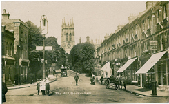
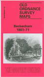
07.15a Beckenham 1861-71 - published 1991; intro by Alan Godfrey
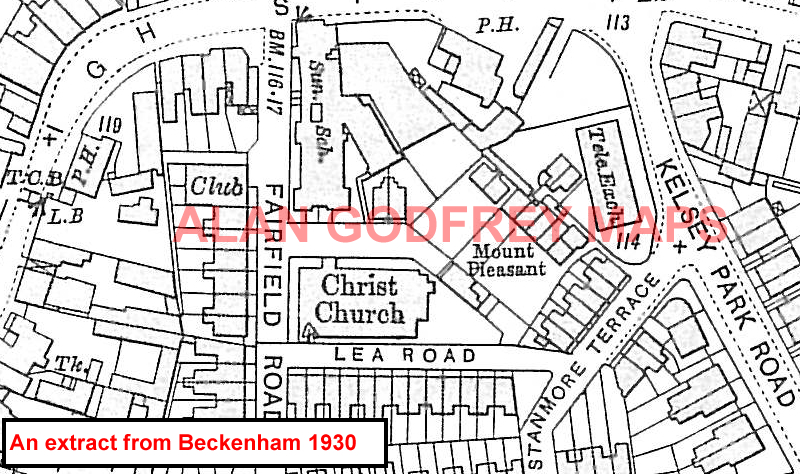
07.15c Beckenham 1930 - published 2005; intro by Alan Godfrey
07.16 Bromley 1861 - published 1991; intro by Alan Godfrey
08.03 Blackfen & Danson Park 1931 - published 2022; intro by Pamela Taylor
08.04 Bexley Heath 1862 - published 1994; intro by Malcolm Barr-Hamilton
08.05 Mottingham 1861 - published 1998; intro by John Kennett
08.06 New Eltham 1895 - published 2001; intro by John Kennett
08.07a Lamorbey & North Sidcup 1895 - published 1993; intro by John Mercer
08.07b Lamorbey & North Sidcup 1931 - published 2022; intro by Pamela Taylor
08.08 Bexley 1870 - published 1998; intro by Malcolm Barr-Hamilton
08.09 Elmstead Wood & Mottingham Estate 1908 - published 2016; intro by Richard Oliver
08.10 Chislehurst (North) 1895 - published 2002; intro by John W Brown
08.11 Sidcup 1908 - published 1993; intro by Malcolm Barr-Hamilton
08.12 North Cray 1895- published 1994; intro by Malcolm Barr-Hamilton
08.14 Chislehurst (South) & Bickley 1895 - published 2016; intro by Pamela Taylor
09.01a Crayford 1907 - published 2001; intro by Stuart Bligh
09.01b Crayford 1931 - published 2022; intro by Pamela Taylor
09.02 Dartford (North) & Crayford East 1931 - published 2022; intro by Pamela Taylor
15.02 South Norwood 1868 - published 1993; intro by Ruth Trevan
15.07 West Wickham & Monk's Orchard 1907 - published 2014; intro by Pamela Taylor
15.08 Hayes 1907 - published 2014; intro by Pamela Taylor
16.07 Orpington 1868 - published 1995; intro by Pamela Taylor
Many other maps for this area, including other maps for Mottingham, Anerley and Beckenham, are
in our London Series.
Also in the Godfrey Edition, some of our One Inch to the Mile maps cover part of the county. See the One Inch page for further details of this
series. The principal 'One Inch' maps for the county, together with other maps in today's County of Kent, are listed on this page.
Most maps in the Godfrey Edition are taken from the 25 inch to the mile map and reduced to about 15 inches to the mile.
They cost just £ 3.00 each (Coloured editions £ 4.00). For a full list of English maps, return to the England page
You can order maps direct from our On-line Mapshop. They are also available from various
local outlets.
Alan Godfrey Maps, Prospect Business Park, Leadgate, Consett, DH8 7PW. Tel 01207 583388
The Godfrey Edition / sales@alangodfreymaps.co.uk / 9 March 2022
 Old Ordnance Survey Maps of Kent (Outer London)
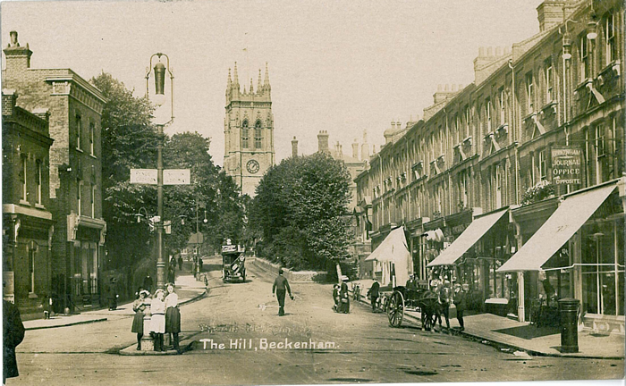 All maps are available from our On-line Mapshop or from selected bookshops in the area.