Old Ordnance Survey Maps of Mottingham


We have published more than 1,800 maps in our series of Old Ordnance Survey Map reprints, some 300 of them in the London area. The maps are highly detailed. They are taken from the OS 1:2,500 (or 25 inch) maps and reduced to about 15 inches to the mile. They show streets with individual houses, tram tracks, railway tracks and even signals, factories, wharves and such details as fountains and water troughs. They will provide hours of fascination for historians and genealogists. The maps are neatly folded and each includes a specially written introduction to the area. Maps can be purchased on our On-line Mapshop where further information about titles is given. Or visit The Index Page for a full list to the series and details of Prices.


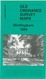
Here are the details of maps for Mottingham:

  • Kent Sheet 8.05 Mottingham 1861 - published 1998; introduction by John Kennett
  • London Sheet 130 Mottingham 1894 - published 1999; introduction by John Kennett

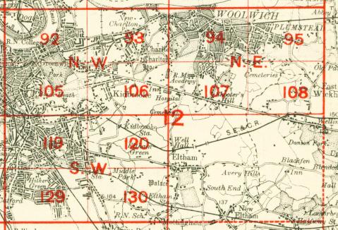
    The two maps listed here are from different series, for Kent and London, and so the sheetlines are somewhat different.


    The very early Kent series map 8.05 is centred on the small village of Mottingham - population just 142 in 1851 - and shows a quite rural area. Buildings include Fairy Hall, Mottingham House, and the map stretches west to College Farm, east to Eltham station. There are directories of Mottingham in 1874 and 1882, plus Sale particulars for the Mottingham House estate. The map links up with Kent Sheet 8.06 New Eltham to the east.


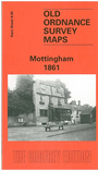
    The London Series map 130 has Mottingham in the SE corner, and this map stretches west to include Burnt Ash Hill, Winn Road and (top left corner) Lee station. Features on a still fairly rural area include Horn Park, Middle Park, and the Royal Naval School. A few streets have now been developed at Mottingham, which now has a street directory.

    An index map showing the areas covered by this and adjacent London maps is available here. The map links up with Sheets 120 Eltham to the north and 129 Catford to the west.


    Follow this link for a complete list of our London maps or this for a list of the Kent maps.

    You can order maps direct from our On-line Mapshop. For other information and prices, go to The Index Page.


    Maps in the Godfrey Edition are taken from the 25 inch to the mile map and reduced to about 15 inches to the mile. For a full list of maps for London, return to the London page

    The Godfrey Edition / godfreyedition@btinternet.com / 10 October 2005