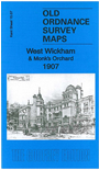
Kent Sheet 15.07 West Wickham & Monk's Orchard 1907 - published 2014; intro by Pamela Taylor. ISBN.978-1-84784-764-5 
This detailed map covers most of West Wickham village and extends westward to Monk's Orchard.
Features include railway with western end of station, Wickham Hall, Wickham House, Ravenswood, part of Langley House (at top margin),
Springfield, Spring Park, Monk's Orchard and grounds, High Broom Wood, Ham Farm etc. We include 1874 and 1905 directories of West Wickham on the reverse.
The map links up with sheet 15.08 Hayes to the east.
For other maps in Bromley see our Bromley page.
Follow this link for a complete list of our London Series maps or this for a list of the Kent Series maps.
You can order maps direct from our On-line Mapshop.
For other information and prices, go to The Index Page.
Maps in the Godfrey Edition are taken from the 25 inch to the mile map and reduced to about 15 inches to the mile.
For a full list of maps for London, return to the London page
The Godfrey Edition / sales@alangodfreymaps.co.uk / 3 December 2016

 Here are the details of maps for West Wickham: