
 Here are the details of maps for East Wickham & Welling:

The two maps listed here are from different series, for Kent and London, and so the sheetlines are somewhat different.
The very early Kent series map includes the village centres of both East Wickham and Welling on the one map. The area was still quite rural, and the railway had not arrived. Only along the Dover Road at Welling and Bell Grove is there any sign of development. The map also includes directories for both villages. The map links up with Kent Sheet 2.16 Bexleyheath (North) to the east.
The 1894 map is centred on East Wickham, still a rural village in 1894, and shows St Michael's church, the Duchess of Edinburgh pub, several greenhouses and a scattering of farms and houses. Welling station is at the foot of the map, which extends northward to Plumstead Cemetery and Woolwich Cemetery, and westward to Shoulder of Mutton Green. The London map does not include the centre of Welling, so we have put a section of the adjacent and contemporary Kent map to extend coverage on the reverse side; this covers the area near Welling station, including Welling village and Bell Grove, with a stretch of the Dover Road. There are also street directory entries for Welling, East Wickham Lane and a few other roads.
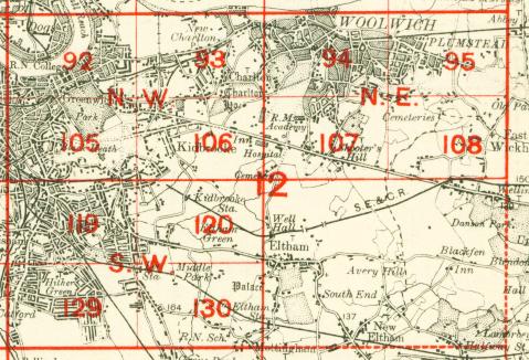
The map links up with Sheets 95 Plumstead to the north and 107 Shooters Hill to the west.
 Follow this link for a complete list of our London maps .