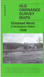
Kent Sheet 8.09 Elmstead Wood & Mottingham Estate 1908 - published 2016; intro by Richard Oliver. ISBN.978-1-78721-008-0 
This highly detailed map covers the area from Grove Park station southward to Elmstead station.
Features include part of Elmstead incl Elmstead Grange, Elmstead Manor, Elmstead Lodge etc; railway incl Grove Park station and part of Bromley Direct Line,
Hall's Farm, Golf Course, Sundridge Hall, etc. On the reverse we include a section of the earlier 1895 map, before Elmstead station had opened.
The map links up with Kent Sheets 8.05 Mottingham to the north, 8.10 Chislehurst North to the east.
For other maps in Bromley see our Bromley page.
Follow this link for a complete list of our London Series maps or this for a list of the Kent Series maps.
You can order maps direct from our On-line Mapshop.
For other information and prices, go to The Index Page.
Maps in the Godfrey Edition are taken from the 25 inch to the mile map and reduced to about 15 inches to the mile.
For a full list of maps for London, return to the London page
The Godfrey Edition / sales@alangodfreymaps.co.uk / 3 December 2016

 Here are the details of maps for Elmstead Wood: