Old Ordnance Survey Maps of the London Borough of Bromley

  • These detailed maps normally cover an area of about one and a half miles by one mile. Each map includes an introduction.
  • They are available through our On-line Mapshop

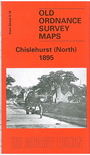
  • Here are the details of maps for Chislehurst (N):

  • Kent Sheet 8.10 Chislehurst (North) 1895 - published 2002; intro by John W Brown. ISBN.978-1-84151-371-3

    This highly detailed map covers the northern side of Chislehurst, from the Queens Head pub northward to Belmont Park Farm. Features include the Church of the Annunciation, police station, Chislehurst West, Red Hill, White Horse Hill, pottery works, Coldharbour Farm, Green Lane, Mead Road, Kemnel Road. There are several large mansions including Kemnal Manor, Foxbury, Homewood, Waratah. A tiny portion of Sidcup (Shirley Road and Longlands Park Rd) is in the NE corner. On the reverse we include directories for Chislehurst in 1874 and 1905.

    The map links up with Kent Sheets 8.06 New Eltham to the north, 8.09 Elmstead Wood to the west, 8.11 Sidcup to the east, 8.14 Chislehurst South to the south.


  • For other maps in Bromley see our Bromley page.
  • Follow this link for a complete list of our London Series maps or this for a list of the Kent Series maps.
  • You can order maps direct from our On-line Mapshop. For other information and prices, go to The Index Page.
  • Maps in the Godfrey Edition are taken from the 25 inch to the mile map and reduced to about 15 inches to the mile. For a full list of maps for London, return to the London page
    The Godfrey Edition / sales@alangodfreymaps.co.uk / 3 December 2016