
 Here are the details of maps for South Norwood:

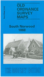
This attractive and highly detailed map covers the area around Norwood Junction station. Development is shown either side of the station, with part of Selhurst Park to the west, including Pawsons Place, High Street, Turnleys Road; and Albert Road, Lincoln Road, Queens Road, Portland Road to the east. Beyond this is open countryside, with Elmersend station at the eastern edge of the map. Further south Enmore Park is shown in an earlier stage of development. Early directories for Selhurst Road, High Street, Portland Road, Albert Road, Woodside Green are included.
An index map showing the areas covered by this and adjacent Kent maps is available here. The map links up with Kent Sheets 7.14 Anerley & Penge to the north.
A map in our London series, 150 South Norwood 1895 is also available on slightly different sheetlines.