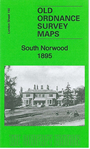
London Sheet 150 South Norwood 1895 - published 2011; intro by Pamela Taylor. ISBN.978-1-84784-484-2 
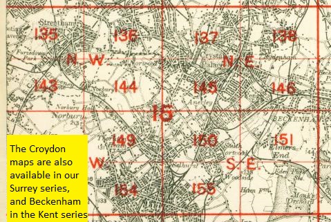
This detailed map covers the area around Norwood Junction. Coverage stretches from Granbgewood House and Charnwood Road eastward to Marlow Road, and from
Warminster Road southward to Enmore Road.
The map links up with London sheets 145 Crystal Palace Crystal Palace to the north, 149 Thornton Heath
to the west, 151 Beckenham South to the east, 155 Croydon NE to the south.. A map in our Kent series, 15.02 South Norwood 1868 is also available, on slightly different sheetlines.
 Follow this link for a complete list of our London maps .
You can order maps direct from our On-line Mapshop.
For other information and prices, and other areas, go to The Index Page.
Follow this link for a complete list of our London maps .
You can order maps direct from our On-line Mapshop.
For other information and prices, and other areas, go to The Index Page.
Maps in the Godfrey Edition are taken from the 25 inch to the mile map and reduced to about 15 inches to the mile.
For a full list of maps for England, return to the England page.
Alan Godfrey Maps, Prospect Business Park, Leadgate, Consett, Co Durham, DH8 7PW / sales@alangodfreymaps.co.uk / 19 February 2018

 Here are the details of maps for South Norwood:
 Follow this link for a complete list of our London maps .