 Here are the details of maps for Belvedere & Lessness Heath:

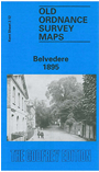
This highly detailed map is double-sided to give maximum coverage. The main map covers an area from West Heath Road and Lessness Abbey eastward to Belvedere Park and Fox House Road, and southward to Erith Cemetery. Features include Abbey Wood (the actual wood, that is), West Heath, Lessness Heath, All Saints church, Royal Alfred Institution. The original name for the area was Lessness Heath, the name Belvedere being adopted in 1858. Though quite a busy map, it still retains a semi-rural air, with the many Victorian houses surrounded by woodland and fields. On the reverse we include half of Sheet 2.11, extending coverage westward to Bostall Heath, Bostall Wood, Shornell's Wood and Plumstead Cemetery; this links the map up with (and slightly overlaps) the Plumstead map and so the London series.
The map links up with Kent Sheets 3.09 Erith to the east and 2.16 Bexleyheath North to the south; also with London Sheet 95 Plumstead to the west.