We have published more than 1,800 maps in our series of Old Ordnance Survey Map reprints, some 300 of them in the London area. The maps are highly detailed. They are taken from the OS 1:2,500 (or 25 inch) maps and reduced to about 15 inches to the mile. They show streets with individual houses, tram tracks, railway tracks and even signals, factories, wharves and such details as fountains and water troughs. They will provide hours of fascination for historians and genealogists. The maps are neatly folded and each includes a specially written introduction to the area. Maps can be purchased on our On-line Mapshop where further information about titles is given. Or visit The Index Page for a full list to the series and details of Prices.
Here are the details of maps for Bexleyheath (N):
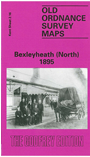
This highly detailed map covers what was still a largely rural area. The Bexleyheath Railway, completed only in 1895, runs west-east across the lower part of the map, with Bexleyheath station towards the SW corner. Past it Pickford Lane runs north-south, later joining Long Lane, but both are still country roads. To the east are Crooked Wood, Bursted Wood, a few houses of Northumberland Heath, the Travellers Rest pub, an isolation hospital, and some orchards. But development was about to begin. We also include a directory.
An index map showing the areas covered by this and adjacent Kent maps is available here. The map links up with Kent Sheets 2.12 Belvedere to the north, 3.13 Barnehurst to the east, 8.04 Bexley Heath to the south.
Follow this link for a complete list of our London Series maps or this for a list of the Kent Series maps.
You can order maps direct from our On-line Mapshop. For other information and prices, go to The Index Page.
Maps in the Godfrey Edition are taken from the 25 inch to the mile map and reduced to about 15 inches to the mile. For a full list of maps for London, return to the London page
The Godfrey Edition / godfreyedition@btinternet.com / 18 October 2005