 Here are the details of maps for Barnehurst & Slades Green:

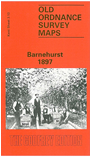
Although we have called our map Barnehurst, the name scarcely appears on the map. The name was given to the station opened here in the 1890s and was derived from the owner of the May Place Estate, Colonel Barne, who also happened to be Vice-Chairman of the Bexleyheath Railway Co. An estate would later take that name. The map covers the area from Northumberland Heath, in the NW corner, eastward to North End and Perry Street. Barnehurst station is at the west of the map and the Bexleyheath Railway crosses west-east, joining up with the North Kent Line. To extend cover westward we include half of sheet 3.14 on the reverse, and this takes coverage to the River Darent, Dartford Creek and the Crayford Marshes. Features on the maps include Slades Green, Normandy Farm, and other farms; there are also several clay pits with their small tramways.
The map links up with Kent Sheets 3.09 Erith to the north, 2.16 Bexleyheath North to the west and 9.01 Crayford to the south.