Old Ordnance Survey Maps of Orpington


We have published more than 1,800 maps in our series of Old Ordnance Survey Map reprints, some 300 of them in the London area and others estending into Kent. The maps are highly detailed. They are taken from the OS 1:2,500 (or 25 inch) maps and reduced to about 15 inches to the mile. Each covers an area of a mile and a half by a mile. They show streets with individual houses, tram tracks, railway tracks and even signals, factories, wharves and such details as fountains and water troughs. They will provide hours of fascination for historians and genealogists. The maps are neatly folded and each includes a specially written introduction to the area. Maps can be purchased on our On-line Mapshop where further information about titles is given. Or visit The Index Page for a full list to the series and details of Prices.


Here are the details of maps for Orpington:

  • Kent Sheet 16.07 Orpington 1868 - published 1995; introduction by Pamela Taylor

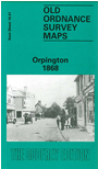
    It was only in the 1920s that Orpington was transformed from a quiet Kentish village into a London suburb, says author Pamela Taylor, and this map captures it in its early rural existence. The southern part of the map has the village centre, with All Saints church, the British School, White Hart inn, remains of an old priory, Broomhill Common, and a few good sized houses near the crossroads. The main (unnamed) road runs in a NE direction across the map to New Town, near Northfield, where we find three planned streets. Nearby is the Corn Mill. Eastward the map extends down country lanes to houses called Ramsden and Petting Grove. On the reverse are directories for Orpington in 1869 and 1875.

    An index map showing the areas covered by this and adjacent Kent maps is available here.


    Follow this link for a complete list of our London Series maps or this for a list of the Kent Series maps.

    You can order maps direct from our On-line Mapshop. For other information and prices, go to The Index Page.


    Maps in the Godfrey Edition are taken from the 25 inch to the mile map and reduced to about 15 inches to the mile. For a full list of maps for London, return to the London page

    The Godfrey Edition / godfreyedition@btinternet.com / 6 October 2005