Old Ordnance Survey Maps of North Cray


We have published more than 1,800 maps in our series of Old Ordnance Survey Map reprints, some 300 of them in the London area. The maps are highly detailed. They are taken from the OS 1:2,500 (or 25 inch) maps and reduced to about 15 inches to the mile. They show streets with individual houses, tram tracks, railway tracks and even signals, factories, wharves and such details as fountains and water troughs. They will provide hours of fascination for historians and genealogists. The maps are neatly folded and each includes a specially written introduction to the area. Maps can be purchased on our On-line Mapshop where further information about titles is given. Or visit The Index Page for a full list to the series and details of Prices.


Here are the details of maps for North Cray:

  • Kent Sheet 8.12 North Cray 1895 - published 1994; introduction by Malcolm Barr-Hamilton

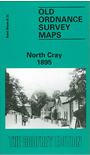
    This detailed OS map covers the village of North Cray, which our author Malcolm Barr-Hamilton says remains the most rural part of Bexley London Borough, of which it is now part. But, as he says, though suburbia has not ruined it, the motor car has, with the winding North Cray Road converted into a dual carriageway. Our map shows a more tranquil era. Features include St James church, North Cray Place, River Cray, Honeyden, Manor Farm, Mount Mascal, Woollet Hall, Gattons Wood, Bunkers Hill, and much of Joydens Wood. North Cray village itself is towards the top of the map.

    An index map showing the areas covered by this and adjacent Kent maps is available here. The map links up with Kent Sheets 8.08 Bexley to the north, 8.11 Sidcup to the west.


    Follow this link for a complete list of our London Series maps or this for a list of the Kent Series maps.

    You can order maps direct from our On-line Mapshop. For other information and prices, go to The Index Page.


    Maps in the Godfrey Edition are taken from the 25 inch to the mile map and reduced to about 15 inches to the mile. For a full list of maps for London, return to the London page

    The Godfrey Edition / godfreyedition@btinternet.com / 25 October 2005