Old Ordnance Survey Maps of Leicestershire
We have a range of detailed maps for Leicestershire towns and we also cover the whole county at the Inch to the Mile scale.
Here are the details.
All maps are available from our On-line Mapshop.
Leicestershire County Council was formed in 1889. There was a reorganisation in 1974, with a county council and eight districts: Blaby,
Charnwood, City of Leicester, Harborough, Hinckley & Bosworth, North West Leicestershire,and Oadby & Wigston. Leicester became a
unitary authority in 1997.
See This Page for a summary of the county's local government history.
 These are the maps we publish for Leicestershire:
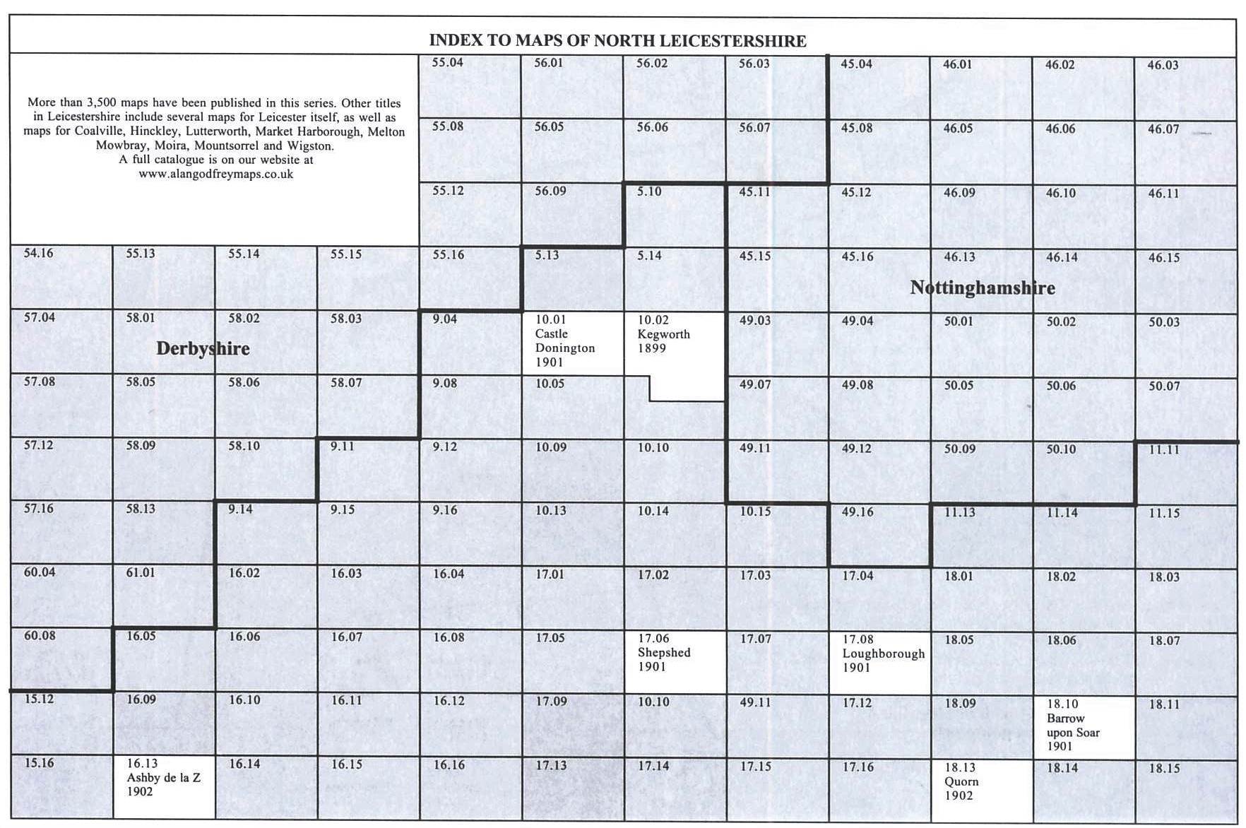
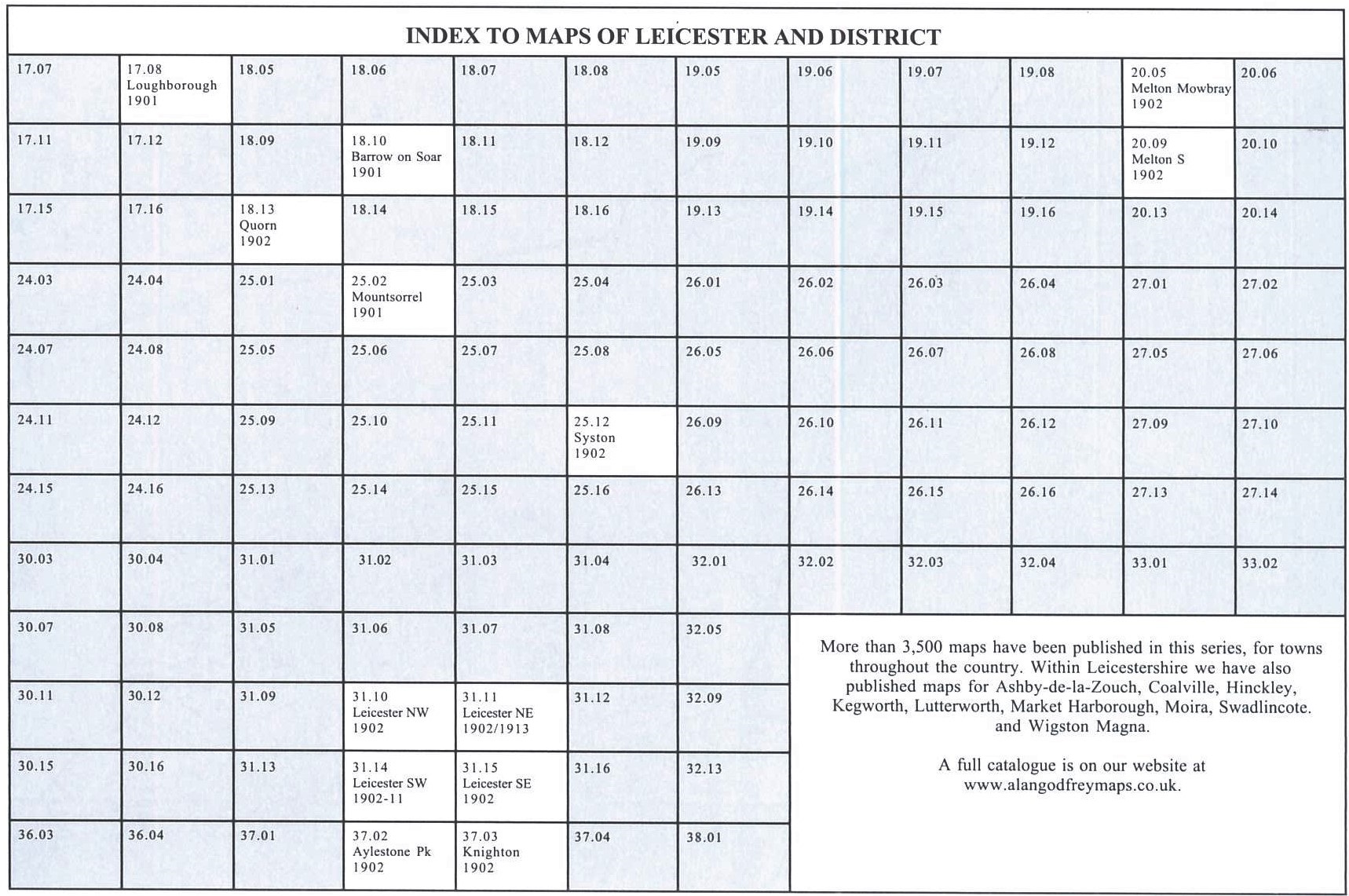
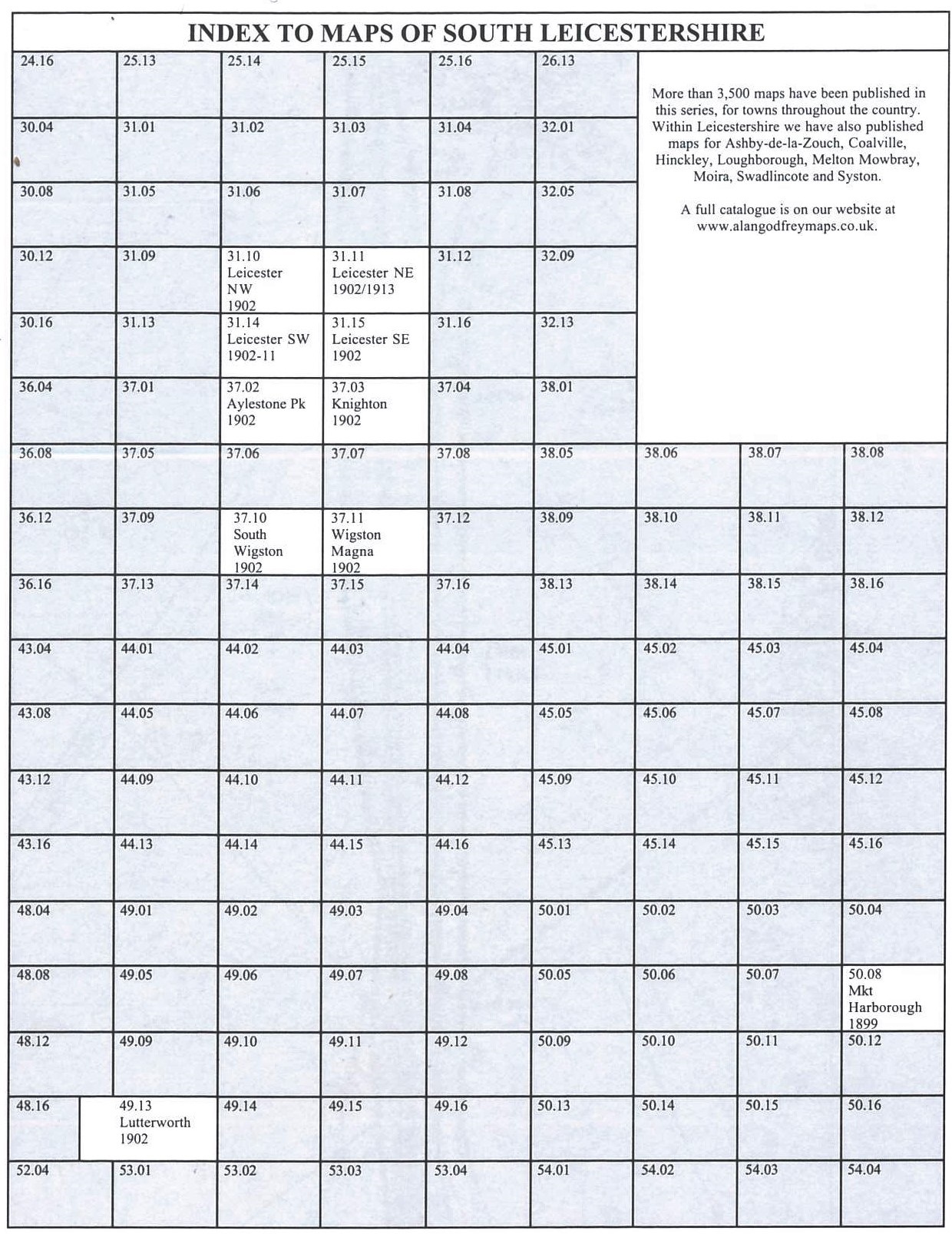
Here are index maps to North Leicestershire, Central Leicestershire
and Leicester and South Leics.
We also cover the county in our Inch to the Mile series. These are the principal sheets for the county:
See the One Inch page for a full list of our Inch to the Mile maps.
 Most maps in the Godfrey Edition are taken from the 25 inch to the mile map and reduced to about 15 inches to the mile.
For a full list of English maps, return to the England page
You can order maps direct from our On-line Mapshop.
This list shows all our maps for the area. We try to keep a full range in print but inevitably some titles fall out of print from time to time. These are noted in our On-line Mapshop.
Most maps in the Godfrey Edition are taken from the 25 inch to the mile map and reduced to about 15 inches to the mile.
For a full list of English maps, return to the England page
You can order maps direct from our On-line Mapshop.
This list shows all our maps for the area. We try to keep a full range in print but inevitably some titles fall out of print from time to time. These are noted in our On-line Mapshop.
Alan Godfrey Maps, Prospect Business Park, Leadgate, Consett, DH8 7PW. Tel 01207 583388
The Godfrey Edition / sales@alangodfreymaps.co.uk / 1 September 2023
 These are the maps we publish for Leicestershire: