Old Ordnance Survey Maps of Leicestershire

  • These detailed maps normally cover an area of about one and a half miles by one mile. Each map includes an introduction.
  • They are available through our On-line Mapshop

  • Here are the details of the map for Hinckley:

  • Leicestershire Sheet 42.08 Hinckley 1901 - published 2013; intro by Barrie Trinder. ISBN.978-1-84784-738-6

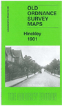
    This very detailed map covers much of Hinckley. The town itself is largely in the NW quadrant of the map, with coverage stretching from the station northward to Druid Street, and from Trinity Lane eastward to Burbage Road.

    Features include railway with station, Sketchley Dye Works, Cork Hole area, St Mary's church, town centre with individual buildings neatly shown, Castle Hill, The Hall, hosiery manufactories, Manor House, schools, St Peter's Priory, Market Place, Hinckley Union Workhouse, Christopher's Spa, The Outwoods, Lash Hill Farm, etc. On the reverse we include extracts from an 1891 directory.


  • Follow this link for a list of our Leicestershire maps or here for Leicester itself.
  • You can order maps direct from our On-line Mapshop. For other information and prices, and other areas, go to The Index Page.
  • Maps in the Godfrey Edition are taken from the 25 inch to the mile map and reduced to about 15 inches to the mile. For a full list of maps for England, return to the England page.
    The Godfrey Edition / sales@alangodfreymaps.co.uk / 6 October 2016