
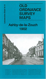
 Here are the details of maps for Ashby-de-la-Zouch:

This very detailed map is double-sided for maximum coverage.
The main map covers the centre and southern part of the town. Features include Main Street, St Helen's church, Midland Railway with station, Royal Hotel, Ivanhoe Baths, Holy Trinity church, Rotherwood, Hungerford House, castle ruins, Highfields, etc.
On the reverse we include a portion of adjacent sheet 16.09, extending coverage north to include Workhouse, Castle Soap Works, Holywell Roller Flour Mills, Gas Works etc.