
Old Ordnance Survey Inch to the Mile Maps
These maps normally cover an area of about 18 miles by 12 miles and are especially good at showing railways, roads and canals, and at giving
a broad view of a wider area. Each includes an introduction and a more detailed map of a small town or village.
They are available through our On-line Mapshop
 Here is information about Sheet 170:
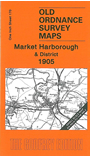
One Inch Sheet 170 Market Harborough & District 1905 - published 2004; intro by Steph Mastoris. ISBN.978-1-84151-676-9
This One Inch to the Mile map is split between Leicestershire and Northamptonshire, with Market Harborough near the centre of the sheet. Coverage stretches
from Lutterworth eastward to Rothwell, and from Kilby and Great Glen station southward to Naseby. Market Harborough is shown as a significant railway centre, with lines going in many directions. On the reverse we
include an extract from Leicestershire Sheet 50.07, showing Lubenham in 1899.
It is not possible to list the many hamlets, farmsteads and other topographical features shown on these maps. However, you might find it useful if we here list the majority of the principal villages
and church parishes that are included on this map. Links are given for those for which detailed large-scale maps are also available.
Leicestershire: Arnesby, Ashby Magna, Blaston, Bruntingthorpe, Catthorpe, Cosby, Cotesbach, Countesthorpe, Cranoe, Dunton Bassett, East Langton, Fleckney, Foston, Foxton, Gilmorton, Glooston, Great Bowden, Gumley,
Husbands Bosworth, Kibworth Beauchamp, Kibworth Harcourt, Kilby, Knaptoft, Laughton, Little Bowden, Lubenham, Lutterworth, Market Harborough, Medbourne, Misterton, Nevill Holt, North Kilworth, Peatling Magna, Peatling Parva,
Saddington, Shangton, Shawell, Shearsby, Slawston, Smeeton Westerby, South Kilworth, Stonton Wyville, Swinford, Theddingworth, Thorpe Langton, Tur Langton, Welham, Willoughby Waterless, Wistow.
Northamptonshire: Arthinmgworth, Ashley, Brampton Ash, Braybrooke, Clipston, Desborough, Dingley, East Farndon, Great Oxenden, Harrington, Haselbech, Kelmarsh, Loddington, Marston Trussell, Naseby,
Orton, Rothwell, Sibbertoft, Stoke Albany, Sutton Bassett, Welford, Weston by Welland, Wilbarston.
Index maps are available showing the areas covered by the Inch to the Mile maps. Go to This page
You can order maps direct from our On-line Mapshop. For a full list of Inch to the Mile maps go to the Inch to the Mile page,
where you will also find details of prices. For information on the rest of the series, go to The Index Page.
Alan Godfrey Maps, Prospect Business Park, Leadgate, Consett, Co Durham, DH8 7PW / sales@alangodfreymaps.co.uk / 16 April 2011