THE ONE INCH MAPS
in The Godfrey Edition
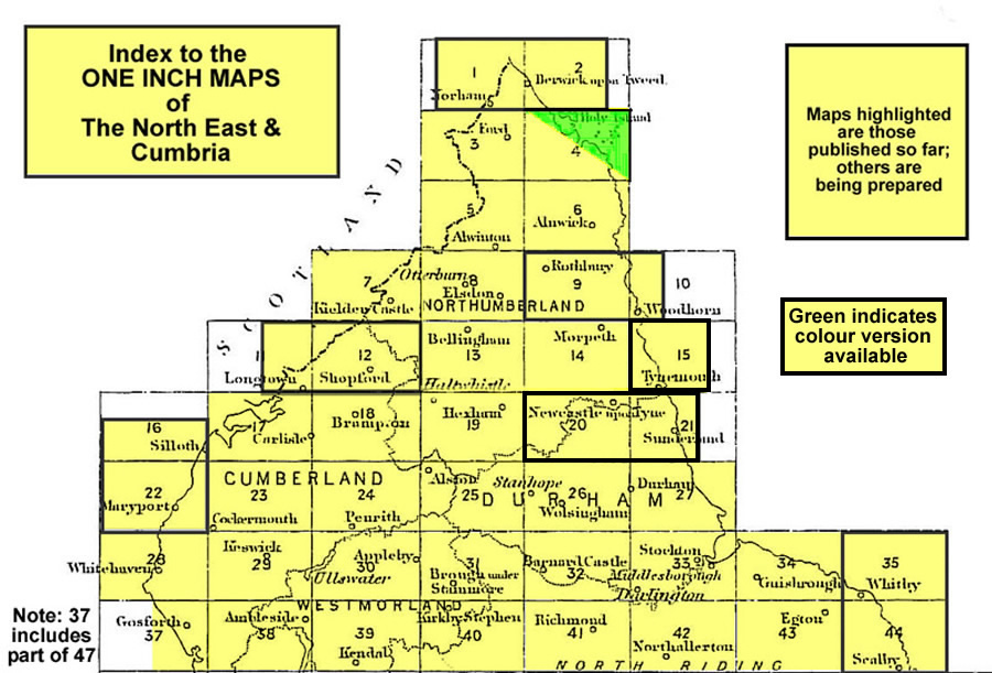
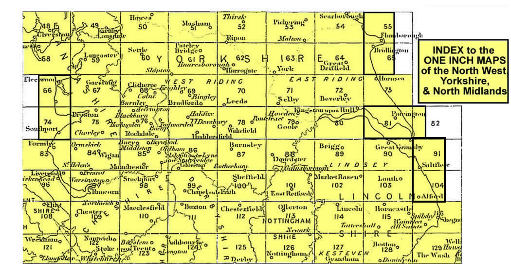
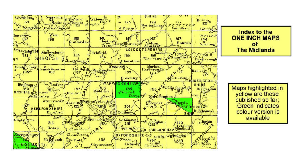
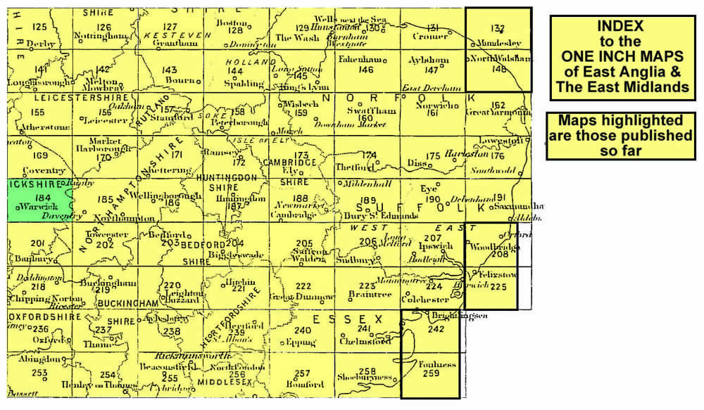
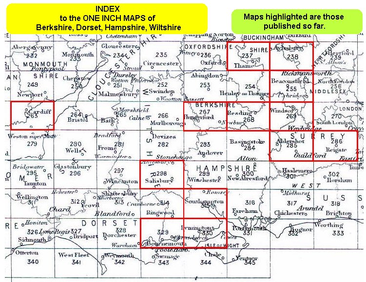
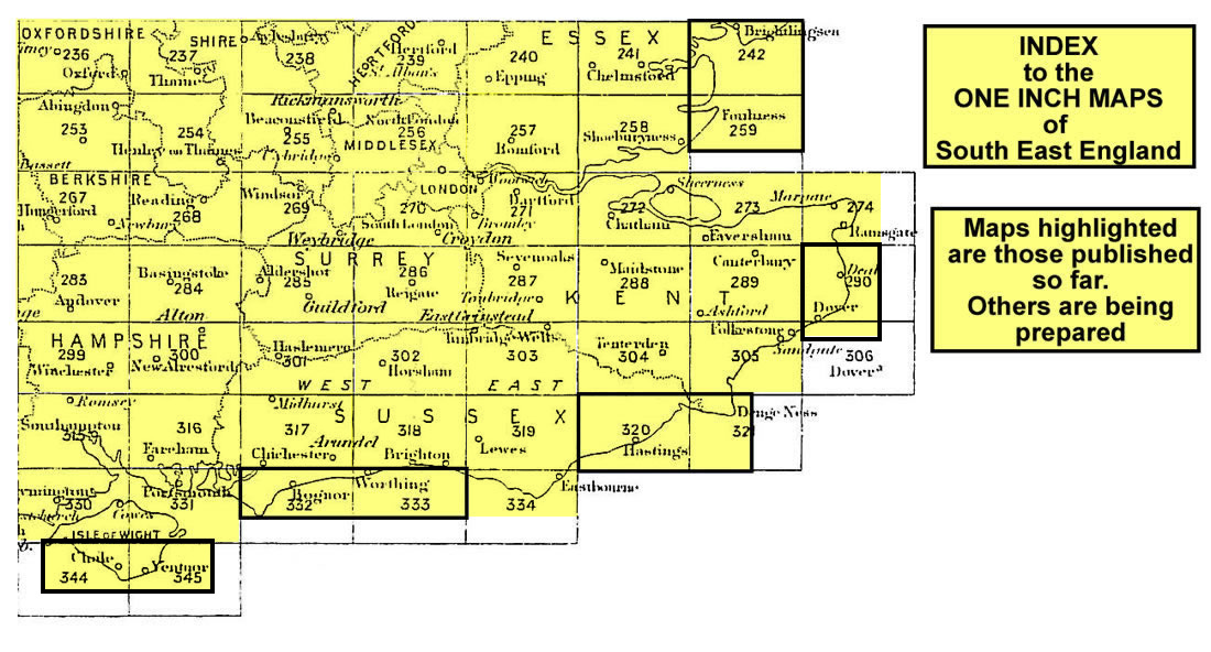
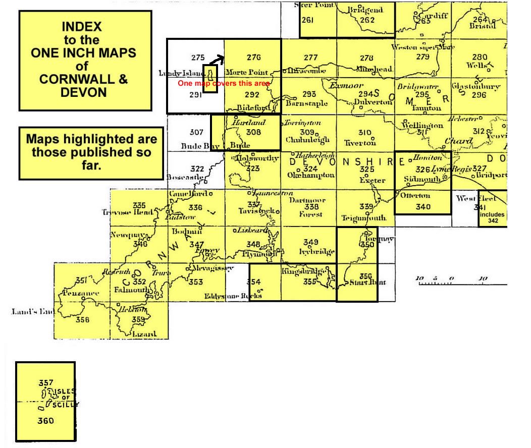
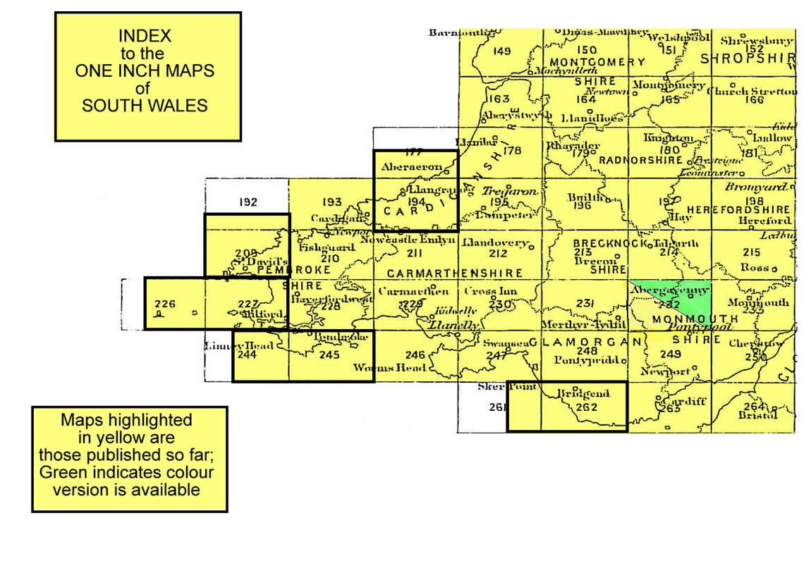
Here are various Index maps covering the One Inch Maps for England & Wales.
The maps published so far have been highlighted in red. The index maps are designed for an 800x600 screen
and have been divided to ensure easy opening; approximate file sizes have been noted.
- Index map for the North East & Cumbria including part of Yorkshire. (112 kb)
- Index map for the North West, Yorkshire & North Midlands. (181 kb)
- Index map for the Midlands. (165 kb)
- Index map for East Anglia & Eastern Counties (incl Beds, Bucks, Cambs, Essex, Herts,
Hunts, Leics, Middx, Norfolk, Suffolk. (190 kb)
- Index map for Wessex & Southern England, incl Berks, Dorset, Hampshire, Wiltshire
& parts of Gloucs, Somerset, Surrey, Sussex etc. (182 kb)
- Index map for the South East including London & the Home Counties. (140 kb)
- Index map for Cornwall & Devon incl part of Somerset. (117 kb)
- Index map for North & Mid Wales. (134 kb)
- Index map for south Wales. (142 kb)
The Godfrey Edition / godfreyedition@BTInternet.com / November 10th 2002