Old Ordnance Survey Maps of Market Harborough


We have published more than 2,000 maps in our series of Old Ordnance Survey Map reprints, including a small group in Leicestershire. The maps are highly detailed. They are taken from the OS 1:2,500 (or 25 inch) maps and reduced to about 15 inches to the mile. Each covers an area of a mile and a half by a mile. They show streets with individual houses, tram tracks, railway tracks and even signals, factories, wharves and such details as fountains and water troughs. They will provide hours of fascination for historians and genealogists. The maps are neatly folded and each includes a specially written introduction to the area. Maps can be purchased on our On-line Mapshop where further information about titles is given. Or visit The Index Page for a full list to the series and details of Prices.


Here are the details of maps for Market Harborough:

  • Leicestershire Sheet 50.08 Market Harborough 1899 - published 2007; intro by Barrie Trinder

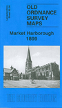
    This very detailed map is double-sided for maximum coverage. The main map covers the centre of Market Harborough, including High Street, The Square, St Mary's Road, Northampton Road and Coventry Road. Features include the brewery, Fairfield Road, Bowden Steam Coffee Mills, Town Hall, malthouse, The Elms, tannery, banks, and all houses shown neatly delineated. Coverage extends northward to the Workhouse, southward to Nithsdale House, westward to the Leicestershire & Northamptonshire Union Canal. Other features include hosiery factory, Hill Crest, Union Wharf, New Harborough with streets under development, shoe factory. On the reverse we include part of adjacent sheet 51.05 extending coverage eastward to include the station (with track layout), engine shed, St Mary's church, Highfield House; the backing map also includes part of Little Bowden, incl Manor House, St Nicholas church, brick & tile works.


    Follow this link for a complete list of our Leicestershire maps.

    You can order maps direct from our On-line Mapshop. For other information and prices, and other areas, go to The Index Page.


    Maps in the Godfrey Edition are taken from the 25 inch to the mile map and reduced to about 15 inches to the mile. For a full list of maps for England, return to the England page.

    The Godfrey Edition / godfreyedition@btinternet.com / 22 June 2007