Old Ordnance Survey Maps of Leicestershire

  • These detailed maps normally cover an area of about one and a half miles by one mile. Each map includes an introduction.
  • They are available through our On-line Mapshop

  • Here are the details of maps for south Melton Mowbray :

  • Leicestershire Sheet 20.09 Melton Mowbray (S) 1902 - published 2014; intro by Barrie Trinder. ISBN.978-1-84784-756-0

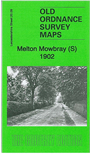
    This very detailed map covers the south side of Melton Mowbray.

    Features include Midland Railway with station, Wyvern Mills, Wicklow Lodge, Wyndham Lodge, Ankle Hill, Mowbray Lodge, Burton Hill, Coventry House, railway approaches from the west, Eye Kettleby Mill, River Eye with Old Lock, Eye Kettleby House, New Guadaloupe etc etc. Extracts from an 1891 directory are included on the reverse.

    The map links up with a companion sheet, 20.05 Melton Mowbray.


  • Follow this link for a list of our Leicestershire maps or here for Leicester itself.
  • You can order maps direct from our On-line Mapshop. For other information and prices, and other areas, go to The Index Page.
  • Maps in the Godfrey Edition are taken from the 25 inch to the mile map and reduced to about 15 inches to the mile. For a full list of maps for England, return to the England page.
    The Godfrey Edition / sales@alangodfreymaps.co.uk / 6 October 2016