Leicestershire Sheet 25.12 Syston 1902 - published 2001; intro by John Gough. ISBN.978-1-84151-283-9 
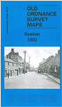
This detailed map covers the village of Syston, a few miles north of Leicester.
Most of the village is covered and features include Midland Railway with station, Syston North Curve, iron foundry, St Peter's church, Queniborough Lodge (at top of map), cemetery, High Street area etc. On the reverse we include an 1891 directory of Syston, plus a 1916 timetable for the Leicester-Peterborough line.
Follow this link for a list of our Leicestershire maps or here for Leicester itself.
You can order maps direct from our On-line Mapshop.
For other information and prices, and other areas, go to The Index Page.
Maps in the Godfrey Edition are taken from the 25 inch to the mile map and reduced to about 15 inches to the mile.
For a full list of maps for England, return to the England page.
The Godfrey Edition / sales@alangodfreymaps.co.uk / 6 October 2016

 Here are the details of maps for Syston: