Old Ordnance Survey One-Inch Maps


These maps are taken from the famous OS "Inch to the Mile" Maps. Though obviously far less detailed than the large scale maps for which we are perhaps better known, they provide an invaluable overview of a wider area, typically 18 miles across by 12 miles down. For transport historians they are invaluable for showing old railways, while all historians need them for their close depiction of topography, including parish boundaries. These maps also mean that we can offer historical coverage for small villages where a large scale map would not be commercially viable. We intend to publish the whole of England and Wales in this series. Almost 200 titles are now available and we aim to publish three new titles each month. The maps include historical notes and all (except the double-sided Tyneside title) also include a large scale map of a small town or village in the area.

The maps are neatly folded and each includes a specially written introduction to the area. Maps can be purchased on our On-line Mapshop where further information about titles is given. Visit the One Inch Page for a full list of Inch to the Mile Maps, or The Index Page for a full list to the series and details of Prices.

Here is information about Sheet 256:

  • One Inch Sheet 256 North London 1902-13 - published 2002; introduction by Pamela Taylor

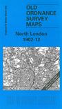
    We have published well over 200 highly detailed maps for London and Middlesex. This Inch to the Mile map is an excellent accompaniment to the series, covering a much broader area but in less detail, and so showing the growing villages of north London and Middlesex in context. Coverage extends from Watford eastward to Chingford and Stratford, and from Enfield southward to the City of London. On the reverse we include a detailed map of the village of Elstree in 1895.


    It is not possible to list the many hamlets, farmsteads and other topographical features shown on these maps. However, you may find it useful if we list the towns and principal villages or church parishes that are included on this map. Links are given for those for which detailed large-scale maps are also available. Please bear in mind we have a very large range of maps for London.

  • Essex: Chingford, Leyton, Walthamstow.
  • Hertfordshire: Aldenham, Arkley, Bushey, Chipping Barnet, East Barnet, Elstree, Monken Hadley, Watford.
  • Middlesex (incl London): City of London, Edgware, Edmonton, Enfield, Finchley, Friern Barnet, Greenford, Hampstead, Harrow on the Hill, Harrow Weald, Hendon, Holborn, Hornsey, Northolt, Paddington, Perivale, Pinner, Southgate, Strand, Tottenham, Totteridge, Wealdstone, Wembley, Willesden, Wood Green.

    For a full list of Inch to the Mile maps go to the One Inch Page; or for London larger scale maps go to the London or Middlesexpage.

    You can order maps direct from our On-line Mapshop. For other information and prices, and other areas, go to The Index Page.


    The Godfrey Edition / godfreyedition@btinternet.com / 13 December 2005