Old Ordnance Survey Maps of Hertfordshire
We have a range of detailed maps for Hertfordshire towns and we also cover the whole county at the Inch to the Mile scale.
Here are the details.
All maps are available from our On-line Mapshop.
Hertfordshire County Council was formed in 1889. There was a reorganisation in 1974, with a county council and ten districts: Broxbourne, Dacorum,
East Herts, Hertsmere, North Hertfordshire, St Albans, Stevenage, Three Rivers, Watford, and Welwyn Hatfield..
See This Page for a summary of the county's local government history.
 These are the maps we publish for Hertfordshire:
07.08 Baldock 1921 - published 1990; introduction by Pamela Taylor
07.11 Letchworth 1938 - published 2025; intro by Barrie Trinder
12.01 Hitchin 1898 - published 1990; intro by Steve Fletcher
12.11 Stevenage 1922 - published 2024; intro by Barrie Trinder
25.14 Tring 1897 - published 1995; intro by Elizabeth Lockwood
27.07 Harpenden 1897 - published 1992; intro by Alan Godfrey
28.11 Welwyn Garden City & Welwyn Village 1922 - published 2024; intro by Barrie Trinder
29.11 North Hertford 1897 - published 1988, rev 2001; intro by Pamela Taylor
29.15 South Hertford 1897 - published 1988; intro by Pamela Taylor
29.12 Ware 1896 - published 1990; intro by Alan Godfrey.
33.05 Berkhamsted 1897 - published 1990; intro by Pamela Taylor
33.11 Boxmoor 1897 - published 1990; intro by Eve Davis
33.08 Hemel Hempstead 1897 - published 1990; intro by Eve Davis
33.12 Hemel Hempstead (South) 1897 - published 1989; intro by Eve Davis
34.07 St Albans (NW) 1897 - published 1989; intro by Pamela Taylor
34.08 St Albans (NE) 1897 - published 1989; intro by Pamela Taylor
34.11 St Albans (SW) 1897 - published 1989; intro by Pamela Taylor
34.12 St Albans (SE) 1897 - published 1989; intro by Pamela Taylor
35.07 Hatfield 1896 - published 1990; intro by Pamela Taylor
37.05 Hoddesden 1896 - published 1990; intro by Pamela Taylor
38.04 Kings Langley 1922 - published 2025; intro by Barrie Trinder
39.05 Abbots Langley 1922 - published 2025; intro by Barrie Trinder
39.12 Radlett 1912 - published 2002; intro by Pamela Taylor
41.08 Cheshunt 1912 - published 2025; intro by Barrie Trinder
41.12 Waltham Cross 1896 - published 2021; intro by Pamela Taylor
43.03 Chorleywood 1896 - published 1991; intro by Alan Godfrey
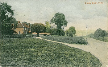
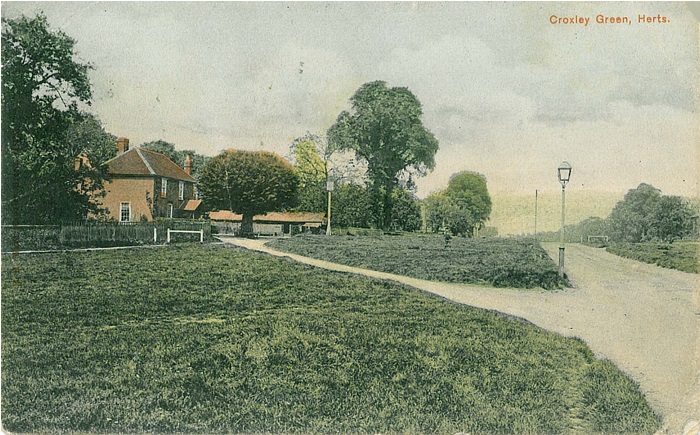
43.08 Rickmansworth & Croxley Green 1896 - published 1990; intro by Pamela Taylor
44.02a Watford 1896 - published 1991; intro by Mary Forsyth
44.02b Watford 1912 - published 2024; intro by Barrie Trinder
44.06a South Watford & New Bushey 1896 - published 1990; intro by Mary Forsyth
44.06b South Watford & Oxhey (New Bushey) 1913 - published 2024; intro by Barrie Trinder
44.13 see Middlesex sheet 5.13 Northwood & Eastbury 1935
45.05 see Middlesex sheet 6.05 Elstree 1895
The following map in our Essex series covers a Hertfordshire town:
Essex 22.15 Bishops Stortford 1896 - published 1991; intro by Pamela Taylor
The following map in our Middlesex series covers a town that is now in Hertfordshire:
Middlesex 1.08 Potters Bar (North) & Littleheath 1896 - published 1995; intro by David Mander
For Barnet and East Barnet see the London borough of Barnet page.
We also cover the whole county in our Inch to the Mile series. These are the principal sheets for the county:
221 North Hertfordshire 1888 - published 2007; intro by Barrie Trinder. Includes a map of Willian
222 Great Dunmow & District 1893- published 2009; intro by Barrie Trinder. Includes a map of Great Dunmow
238 North Chilterns 1888 - published 1997; intro b y Alan Godfrey. Includes a map of Aldbury
239 Hertford & St Albans 1898- published 2009; intro by Barrie Trinder. Includes a map of Welwyn village
255 South Chilterns 1886 - published 1997; intro by Elizabeth Lockwood. Includes a map of Chalfont St Peter
256 North London - published 2002; intro by Pamela Taylor. Includes a map of Elstree
Visit the One Inch page for further details of this series.
 Most maps in the Godfrey Edition are taken from the 25 inch to the mile map and reduced to about 15 inches to the mile.
For some adjacent counties go to the Chilterns page.
For a full list of English maps, return to the England page
This list shows all our maps for the county. We try to keep a full range in print but inevitably some titles fall out of print from time to time.
These are noted in our On-line Mapshop.
Most maps in the Godfrey Edition are taken from the 25 inch to the mile map and reduced to about 15 inches to the mile.
For some adjacent counties go to the Chilterns page.
For a full list of English maps, return to the England page
This list shows all our maps for the county. We try to keep a full range in print but inevitably some titles fall out of print from time to time.
These are noted in our On-line Mapshop.
Alan Godfrey Maps, Prospect Business Park, Leadgate, Consett, DH8 7PW. Tel 01207 583388
The Godfrey Edition / sales@alangodfreymaps.co.uk / 6 March 2025
 These are the maps we publish for Hertfordshire: