
 Here are the details of maps for Watford:

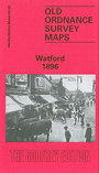
This detailed map covers the centre of Watford, with coverage stretching from Watford Place and the High Street northward to Watford Junction station and Park Road, and from Alexandra Road eastward to The Hall and Hall Road.
Features include railway with Watford Junction station, engine shed, High Street station (at foot of map), St Mary's church, Watford Place, Southfield House, Council Offices, The Elms, Cassio Hamlet, Watford House, Clarendon Hall, town centre with individual buildings neatly shown, London Orphan Asylum, River Colne, Busheymead House, Printing Works, Hall Nursery, The Hall, etc. On the reverse we include a list of private residents from an 1899 directory.
The map links up with Hertfordshire sheet 44.06 South Watford to the south.