Old Ordnance Survey Maps of Hertfordshire

  • These detailed maps normally cover an area of about one and a half miles by one mile. Each map includes an introduction.
  • They are available through our On-line Mapshop

  • Here are the details of maps for Hitchin:

  • Hertfordshire Sheet 12.01 Hitchin 1898 - published 1990; intro by Steve Fletcher. ISBN.978-0-85054-395-7

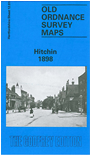
    This detailed map is double-sided, to give maximum coverage of the market town of Hitchin. The main map covers the town centre, with coverage extending westward to Foxholes, northward to Butts Close. Features include St Mary's church, The Priory, Windmill Hill, The Grove, Holy Saviour's church, Whinbush Grove, Lavender Distillery, Leather Dressing Works, engine shed, Market Place, High Street, Rosenburg, Infirmary, Workhouse, cemetery and much more. On the reverse we include a portion of adjacent sheet 12.02 extending coverage eastward to include the station.


  • Follow this link for a complete list of our Hertfordshire Series maps or go to the Chilterns page for other counties in the region.
  • You can order maps direct from our On-line Mapshop. For other information and prices, and other areas, go to The Index Page
  • Maps in the Godfrey Edition are taken from the 25 inch to the mile map and reduced to about 15 inches to the mile. For a full list of maps for England, return to the England page.
    The Godfrey Edition / sales@alangodfreymaps.co.uk / 28 January 2018