Old Ordnance Survey Maps of Hertfordshire

  • These detailed maps normally cover an area of about one and a half miles by one mile. Each map includes an introduction.
  • They are available through our On-line Mapshop

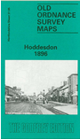
  • Here are the details of maps for Hoddesdon:

  • Hertfordshire Sheet 37.05 Hoddesdon 1896 - published 1990; intro by Pamela Taylor. ISBN.978-0-85054-443-5

    This detailed map covers most of the town of Hoddesdon, with coverage stretching eastward to the River Lea Navigation, and also from Middle Field Road southward to Upper Marsh Lane.

    Features include town centre with individual buildings neatly shown, Town Hall, Brewery, Rawdon House, St Catherine's church, Manor Farm, Burford House, Cherrytree Farm, Esdale House, watercress beds, New River, railway with Broxbourne Junction but no stations, Dobsweir Bridge, The Lynch, Field's Weir etc. On the reverse we include a contemporary directory.


  • Follow this link for a complete list of our Hertfordshire Series maps or go to the Chilterns page for other counties in the region.
  • You can order maps direct from our On-line Mapshop. For other information and prices, and other areas, go to The Index Page
  • Maps in the Godfrey Edition are taken from the 25 inch to the mile map and reduced to about 15 inches to the mile. For a full list of maps for England, return to the England page.
    The Godfrey Edition / sales@alangodfreymaps.co.uk / 28 January 2018