Old Ordnance Survey Maps of Hertfordshire

  • These detailed maps normally cover an area of about one and a half miles by one mile. Each map includes an introduction.
  • They are available through our On-line Mapshop

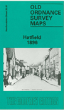
  • Here are the details of maps for Hatfield:

  • Hertfordshire Sheet 35.07 Hatfield 1896 - published 1990; intro by Pamela Taylor. ISBN.978-0-85054-374-2

    This detailed map covers most of the town of Hatfield, with coverage extending from the New Town eastward to Hatfield Park, and from Dagmar House and the Red Lion Hotel southward to the New Gardens.

    Features include Hatfield House, GNR railway with station, sidings etc, junction with St Albans line, St Etheldreda's church, Lawn House, One Bell, Glebe Cottages, Rectory, Broomfield Cottages, Northcotts, St Audrey's, Hatfield Workhouse, Primrose Cottages, White Lion pub etc. On the reverse we include an 1899 directory of Hatfield.


  • Follow this link for a complete list of our Hertfordshire Series maps or go to the Chilterns page for other counties in the region.
  • You can order maps direct from our On-line Mapshop. For other information and prices, and other areas, go to The Index Page
  • Maps in the Godfrey Edition are taken from the 25 inch to the mile map and reduced to about 15 inches to the mile. For a full list of maps for England, return to the England page.
    The Godfrey Edition / sales@alangodfreymaps.co.uk / 28 January 2018