.
 We also publish a series of Inch to the Mile maps. These are the principal sheets for Glamorgan:
230 Ammanford & District 1908 - published 2006; intro by Derrick Pratt.
231 Merthyr & District 1908 - published 2006; intro by Derrick Pratt. Includes Aberdare and Merthyr Tydfil.
232 NW Monmouthshire 1914 - published 2006; intro by Derrick Pratt.
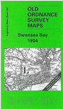
247 Swansea Bay 1904 - published 2004; intro by Louise Miskell. Includes a map of Penclawdd.
248 Rhondda Valley 1904-14 - published 2007; intro by Derrick Pratt.
249 Newport, Caerphilly & District 1894 - published 2003; intro by Martin Culliford. Includes a map of Llanvihangel.
262 Vale of Glamorgan 1904 - published 2006; intro by Derrick Pratt.
263 Cardiff & District 1890 - published 1999; intro by John Davies. Includes a map of Llanishen.
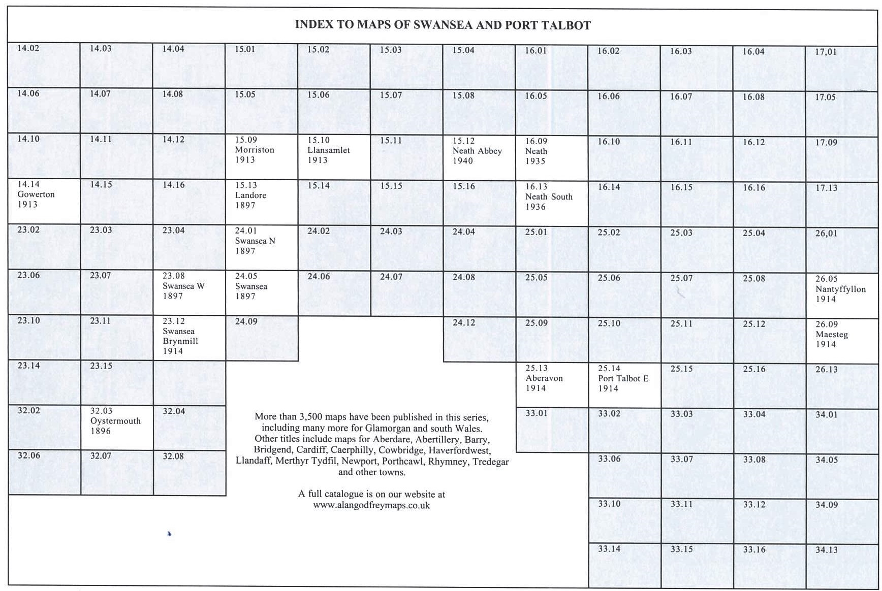
For a full list and index maps follow this link.
 Most maps in the Godfrey Edition are taken from the 25 inch to the mile map and reduced to about 15 inches to the mile.
For a full list of Welsh maps, return to the Wales page.
This list shows all our maps for the area. We try to keep a full range in print but inevitably some titles fall out of print from time to time.
These are noted in our On-line Mapshop.
Most maps in the Godfrey Edition are taken from the 25 inch to the mile map and reduced to about 15 inches to the mile.
For a full list of Welsh maps, return to the Wales page.
This list shows all our maps for the area. We try to keep a full range in print but inevitably some titles fall out of print from time to time.
These are noted in our On-line Mapshop.
Alan Godfrey Maps, Prospect Business Park, Leadgate, Consett, DH8 7PW. Tel 01207 583388
The Godfrey Edition / sales@alangodfreymaps.co.uk / 12 February 2026

 These are the maps we publish in Glamorgan:
