Old Ordnance Survey Maps of Glamorgan

  • These detailed maps normally cover an area of about one and a half miles by one mile. Each map includes an introduction.
  • They are available through our On-line Mapshop

  • Here are the details of maps for Aberdare (E):

  • Glamorgan Sheet 11.16 Aberdare (East) & Cwmbach 1914 - published 2010; intro by Derrick Pratt. ISBN.978-1-84784-371-5

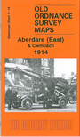
    This detailed map covers the eastern part of Aberdare, around Lewis Street, with coverage extending eastward to Cwmbach, northward to Ty-draw Place.

    Features include Abergwawr Colliery, Cwmbach, Upper Dyffryn Colliery (disused), Lletty-Shenkin Quarry, stretch of Taff Vale Railway, Cwmbach Pit (disused), old inclines, Tunnel Pit (disused), Ynys-cynon House, Crichton Drift, disused Aberdare Canal. An Aberdare commercial directory entries Ow-Z is included on the reverse.

    The map links up with Glamorgan sheet 11.15 Aberdare to the west.


  • Follow this link for a complete list of our Glamorgan maps.
  • You can order maps direct from our On-line Mapshop. For other information and prices, and other areas, go to The Index Page.
  • Maps in the Godfrey Edition are taken from the 25 inch to the mile map and reduced to about 15 inches to the mile. For a full list of maps for Wales, return to the Wales page.
    The Godfrey Edition / sales@alangodfreymaps.co.uk / 30 March 2018