Old Ordnance Survey One-Inch Maps


These maps are taken from the famous OS "Inch to the Mile" Maps. Though obviously far less detailed than the large scale maps for which we are perhaps better known, they provide an invaluable overview of a wider area, typically 18 miles across by 12 miles down. For transport historians they are invaluable for showing old railways, while all historians need them for their close depiction of topography, including parish boundaries. These maps also mean that we can offer historical coverage for small villages where a large scale map would not be commercially viable. We intend to publish the whole of England and Wales in this series. Almost 200 titles are now available and we aim to publish three new titles each month. The maps include historical notes and almost all also include a large scale map of a small town or village in the area.

The maps are neatly folded and each includes a specially written introduction to the area. Maps can be purchased on our On-line Mapshop where further information about titles is given. Visit the One Inch Page for a full list of Inch to the Mile Maps, or The Index Page for a full list to the series and details of Prices.

Here is information about Sheet 230:

  • One Inch Sheet 23029 Ammanford & District 1908 - published 2006; introduction by Derrick Pratt

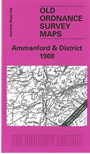
    This Inch to the Mile map, which is centred on Ammanford, is split between Carmarthenshire and Glamorgan, with a small portion of Brecknockshire to the NE. Coverage stretches from Pontyberem station and Middleton Hall eastward to Ystradgynlais, and from Llanarthney (or Llanarthne) southward to Pontardulais. Features include the Swansea Valley and Swansea Canal in the SE corner, part of the Black Mountains in the NE, Mynydd Bettws in the centre, the lower stages of the Central Wales railway. On the reverse we include an extract from Carmarthenshire Sheet 41.15, showing Llandybie in 1905, including St Tybie's church, station, Pant-yr-odyn and quarry to the north.


    It is not possible to list the many hamlets, farmsteads and other topographical features shown on these maps. However, you may find it useful if we list the towns and principal villages or church parishes that are included on this map:

  • Brecknockshire: Ystradgynlais.
  • Carmarthenshire: Ammanford, Brynamman, Glanamman, Llanarthney, Llandybie, Llanedy, Llanegwad, Llanfihangel-Aberbythych, Llannon.
  • Glamorgan: Cilybebyll, Llangiwg, Pontardawe, Pontardulais.

    For a full list of large scale maps go to the Wales page or or local maps go to the Carmarthen page.

    You can order maps direct from our On-line Mapshop. For other information and prices, and other areas, go to The Index Page.


    The Godfrey Edition / godfreyedition@btinternet.com / 2 Feb 2006