
 Here are the details of maps for Pengam & Roath:

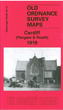
This very detailed map covers an area of east Cardiff stretching from Nora Street eastward to Pengam Moors, and from Coventry Street northward to Deri Road.
Features include Roath station, GWR line with Pengam Sidings and Junction, Taff Vale Railway Roath Branch, Waterloo Gardens, St Margaret's church, tramways and depot, Pengam, Roath Pottery, Biscuit Works. On the reverse we include a selection of street directory entries including Broadway, Carlisle Street, Pearl Street, Richards Terrace.
The map links up with sheet 43.11 Cardiff North to the west and 43.16 East Moors to the south.