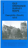
Glamorgan Sheet 37.06 Caerphilly (South) 1915 - published 2009; intro by Derrick Pratt. ISBN.978-1-1-84784-264-0 
This very detailed map covers the south of Caerphilly, much of it woodland shown as The Warren. Urban information includes a stretch of the Rhymney Railway with Railway Works and part of station, St Martin's church,
Caerphilly Tunnel, Nant-y-calch Quarry, Werddu Clay Pits. On the reverse we include some directory information.
The map links up with sheet 37.02 Caerphilly North to the north.
Follow this link for a complete list of our Glamorgan maps.
You can order maps direct from our On-line Mapshop.
For other information and prices, and other areas, go to The Index Page.
Maps in the Godfrey Edition are taken from the 25 inch to the mile map and reduced to about 15 inches to the mile.
For a full list of maps for Wales, return to the Wales page.
The Godfrey Edition / sales@alangodfreymaps.co.uk / 30 March 2018

 Here are the details of maps for Caerphilly (South):