
 Here is information about Sheet 263:
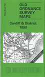
This small scale Inch to the Mile complements our series of more detailed maps for Cardiff and its environs. Coverage stretches from Peterston super Ely eastward to St Mellons, and from Llanishen southward to Barry, with Cardiff itself near the centre of the map. Across the Seven Estuary a fragment of Somerset is visible, with Flat Holm in the middle of the sea. On the reverse we include an extract from Glamorgan Sheet 37.15, showing the village of Llanishen in detail, including St Isan's church and station, and including a directory.
It is not possible to list the many hamlets, farmsteads and other topographical features shown on these maps. However, you may find it useful if we list the towns and principal villages or church parishes that are included on this map. Links are given for those for which detailed large-scale maps are also available.
Index maps are available showing the areas covered by the Inch to the Mile maps. Go to This page
You can order maps direct from our On-line Mapshop. For a full list of Inch to the Mile maps go to the Inch to the Mile page, where you will also find details of prices. For information on the rest of the series, go to The Index Page.