Old Ordnance Survey Maps of Glamorgan

  • These detailed maps normally cover an area of about one and a half miles by one mile. Each map includes an introduction.
  • They are available through our On-line Mapshop

  • Here are the details of maps for Caerphilly (West):

  • Glamorgan Sheet 37.01 Caerphilly (West) 1937 - published 2009; intro by Derrick Pratt. ISBN.978-1-84784-316-6

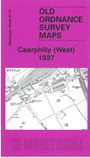
    This very detailed map covers the western fringe of Caerphilly, with coverage stretching from Nantgarw Road and Caenant Road westward. Features include stretches of the GWR railway, including Aber Junction, Aber Junction Halt, Penyrheol Halt, Beddau Sidings, part of the Senghenydd Branch. The former Barry Railway route is shown being dismantled. Other features include Old Furnace, Pen-yr-Heol, cemetery, Pandy, Omnibus Depot, Trecenydd area etc. On the reverse we include the 1929 Cardiff-Caerphilly-Rhymney timetable.

    The map links up with sheets 37.02 Caerphilly (North) to the east.


  • Follow this link for a complete list of our Glamorgan maps.
  • You can order maps direct from our On-line Mapshop. For other information and prices, and other areas, go to The Index Page.
  • Maps in the Godfrey Edition are taken from the 25 inch to the mile map and reduced to about 15 inches to the mile. For a full list of maps for Wales, return to the Wales page.
    The Godfrey Edition / sales@alangodfreymaps.co.uk / 30 March 2018