Old Ordnance Survey Maps of Canton


We have published more than 2,000 maps in our series of Old Ordnance Survey Map reprints, and have now started work on a group for Glamorgan. The maps are highly detailed. They are taken from the OS 1:2,500 (or 25 inch) maps and reduced to about 15 inches to the mile. Each covers an area of a mile and a half by a mile. They show streets with individual houses, tram tracks, railway tracks and even signals, factories, wharves and such details as fountains and water troughs. They will provide hours of fascination for historians and genealogists. The maps are neatly folded and each includes a specially written introduction to the area. Maps can be purchased on our On-line Mapshop where further information about titles is given. Or visit The Index Page for a full list to the series and details of Prices.


  • Here are the details of maps for Canton:

  • Glamorgan Sheet 43.14 Cardiff (Canton & Riverside) 1940 - published 2008; introduction by Alan Godfrey

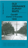
    This very detailed map covers the Canton area and part of the Riverside area of Cardiff. Coverage stretches from Cathedral Road and Neville Street westward to Victoria Park, and southward to Virgil Street. Features include Canton railway depot with engine shed, carriage sheds, turntable, sidings etc; Ninian Park football ground, St John's church, tramways, City Isolation Hospital, Canton Brick Works, Ely River, St Luke's church, malthouse, slaughter-house, cinemas, City Lodge, Leckwith Road and many streets of terraced housing, with individual houses neatly delineated. On the reverse we include extracts from a 1906 street directory, incl for Alexander Road, Atlas Road, Cowbridge Road, Beda Road, Craddock Street, Leckwith Road.


    Follow this link for a complete list of our Glamorgan maps.

    You can order maps direct from our On-line Mapshop. For other information and prices, and other areas, go to The Index Page.


    Maps in the Godfrey Edition are taken from the 25 inch to the mile map and reduced to about 15 inches to the mile. For a full list of maps for Wales, return to the Wales page.

    The Godfrey Edition / godfreyedition@btinternet.com / 21 March 2008