Old Ordnance Survey Maps of Glamorgan

  • These detailed maps normally cover an area of about one and a half miles by one mile. Each map includes an introduction.
  • They are available through our On-line Mapshop

  • Here are the details of maps for Taff's Well:

  • Glamorgan Sheet 36.12 Taff's Well 1875 - published 2009; intron by Derrick Pratt. ISBN.978-1-84784-339-5

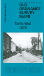
    This detailed map covers the area around and to the north of Taff's Well, including Glan-y-llyn and Gwaclod-y-garth.

    Features include Taff Vale Railway and Rhymney Railway (Walnut Tree Bridge Branch) but no stations; Taffswell Ferry, River Taff, schools and chapels, Bryn-coch Colliery, Bryn-coch Brickworks, Glamorganshire Canal, Garth Hill, old quarries etc. We include 1906 directories of Pentyrch and Eglwysilan on the reverse.

    The map links up with sheet 36.08 Nantgarw to the north.


  • Follow this link for a complete list of our Glamorgan maps.
  • You can order maps direct from our On-line Mapshop. For other information and prices, and other areas, go to The Index Page.
  • Maps in the Godfrey Edition are taken from the 25 inch to the mile map and reduced to about 15 inches to the mile. For a full list of maps for Wales, return to the Wales page.
    The Godfrey Edition / sales@alangodfreymaps.co.uk / 30 March 2018