Old Ordnance Survey One-Inch Maps


These maps are taken from the famous OS "Inch to the Mile" Maps. Though obviously far less detailed than the large scale maps for which we are perhaps better known, they provide an invaluable overview of a wider area, typically 18 miles across by 12 miles down. For transport historians they are invaluable for showing old railways, while all historians need them for their close depiction of topography, including parish boundaries. These maps also mean that we can offer historical coverage for small villages where a large scale map would not be commercially viable. We intend to publish the whole of England and Wales in this series. Almost 200 titles are now available and we aim to publish three new titles each month. The maps include historical notes and all (except the double-sided Tyneside title) also include a large scale map of a small town or village in the area.

The maps are neatly folded and each includes a specially written introduction to the area. Maps can be purchased on our On-line Mapshop where further information about titles is given. Visit the One Inch Page for a full list of Inch to the Mile Maps, or The Index Page for a full list to the series and details of Prices.

Here is information about Sheet 247:

  • One Inch Sheet 247 Swansea Bay 1904 - published 2004; introduction by Louise Miskell

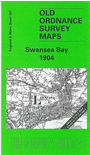
    The Inch to the Mile map covers the area around Swansea, Mumbles Head and Neath. Coverage stretches from Llanelly eastward to Port Talbot, and from Oxwich Point northward to Llangennech and Clydach. Swansea is near the centre of the map, and close examination reveals a wealth of fine detail, including the railways of the area, many of them long since closed, such as the Swansea Bay Railway, the Swansea & Mumbles Railway and the Rhondda & Swansea Bay Railway. The coastline is always interesting, from the rocks of Mumbles Head to the sands of Baglan Bay. On the reverse we include an extract from Glamorgan Sheet 22.04, covering the village of Penclawdd in more detail, already showing several disused collieries and quarries by 1913.


    It is not possible to list the many hamlets, farmsteads and other topographical features shown on these maps. However, you may find it useful if we list the towns and principal villages or church parishes that are included on this map. Links are given for those for which detailed large-scale maps are also available.

  • Carmarthenshire: Llanelly, Llangennech.
  • Glamorgan: Aberavon, Bishopston, Briton Ferry, Clydach, Cockett, Dyffryn Clydach, Gowerton, Ilston, Llandore, Llansamlet, Loughor, Morriston, Neath, Nicholaston, Penard, Penclawdd, Penmaen, Port Talbot, Swansea, The Mumbles.

    For a full list of Inch to the Mile maps go to the One Inch Page; or for larger scale maps of Wales go to the Wales page.

    You can order maps direct from our On-line Mapshop. For other information and prices, and other areas, go to The Index Page.


    The Godfrey Edition / godfreyedition@btinternet.com / 12 January 2006